
About ESA
The European Space Agency (ESA) is Europe’s gateway to space. Its mission is to shape the development of Europe’s space capability and ensure that investment in space continues to deliver benefits to the citizens of Europe and the world.
Highlights


Latest


Space in Member States
Find out more about space activities in our 23 Member States, and understand how ESA works together with their national agencies, institutions and organisations.
 Germany
 Austria
 Belgium
 Denmark
 Spain
Spain
 Estonia
 Finland
 France
 Greece
 Hungary
 Ireland
 Italy
Italy
 Luxembourg
 Norway
 The Netherlands
 Poland
 Portugal
 Czechia
 Romania
 United Kingdom
 Slovenia
 Sweden
 Switzerland
Science & Exploration
Exploring our Solar System and unlocking the secrets of the Universe
Go to topicAstronauts


Latest


Enabling & Support
Making space accessible and developing the technologies for the future
Go to topicLatest


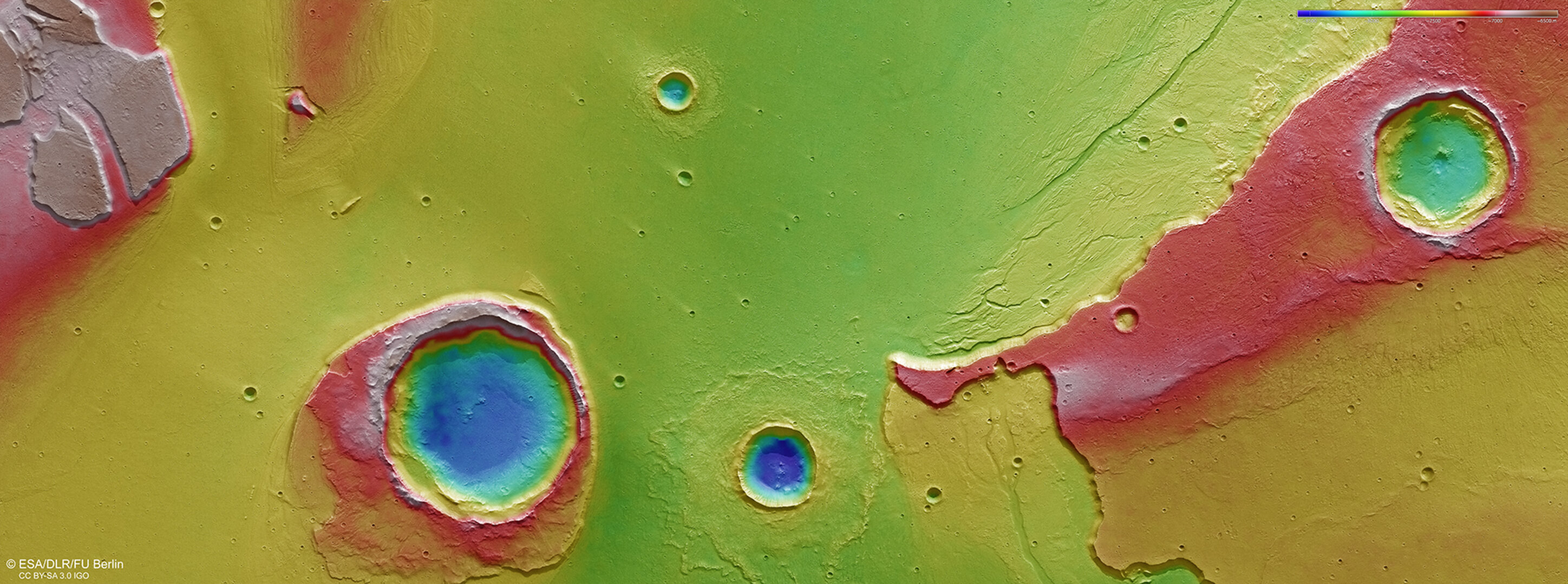
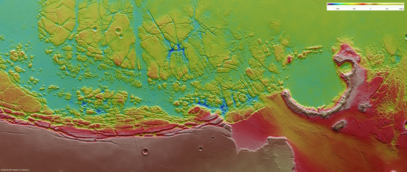
Topography at the mouth of Kasei Valles
The colour-coded topographic view shows relative heights and depths of terrain in the region of Mars where Kasei Vallis reaches Chryse Planitia. As indicated in the key at top right, whites and reds represent the highest terrain, while blue is the lowest.
The image is based on a digital terrain model of the region, from which the topography of the landscape can be derived.
This region was imaged by the High Resolution Stereo Camera on ESA’s Mars Express on 25 May 2016 during orbit 15714. The image is centred on 309ºE/27ºN and the ground resolution is about 15 m per pixel. North is to the right.
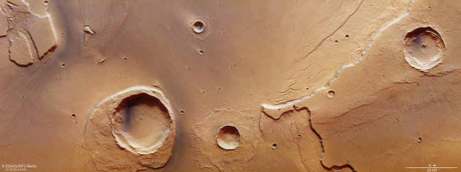
At the mouth of Kasei Valles
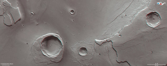
Anaglyph view at the mouth of Kasei Vallis
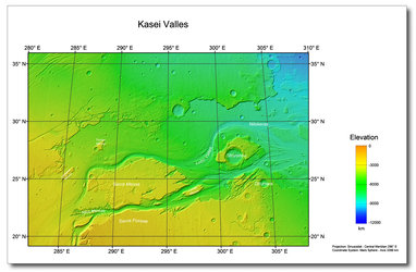
Kasei Valles topography
Kasei Valles and Sacra Fossae ortho-image. North is…
