Sentinel-1 monitoring motion
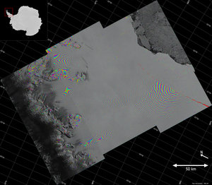
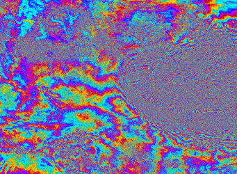
Radar images from Sentinel-1 can be used to generate 3D models of Earth’s surface and to closely monitor land and ice surface deformation. Synthetic aperture radar interferometry – or InSAR – is a technique where two or more satellite radar images acquired over the same area are combined to produce an interferogram. Small changes on the ground cause changes in the radar signal phase and lead to rainbow-coloured fringes in the interferogram. These products are important for mapping topography to produce ‘digital elevation models’ and to monitor surface deformation caused by, for example, mining, earthquakes, volcanic activity, melting permafrost and glacial flow. The Sentinel-1A satellite passes over the same spot on the ground every 12 days. However, once its identical twin, Sentinel-1B, is launched in 2016, this will be cut to just six days, so that changes can be mapped even faster.


