Portugal preps for Copernicus
With the Copernicus environmental monitoring programme’s first satellite nearing launch, Portugal explores how best to exploit this initiative’s critical information.
In order to stimulate the use of satellite-derived data within public administration, Portugal has created the Working Group for Earth Observation (GTOT). The group’s main focus is on information from Copernicus, including data from the upcoming Sentinel satellites.
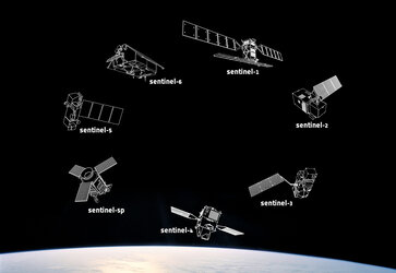
The first Sentinel, set for launch this spring, will be used to care for many aspects of our environment, from detecting and tracking oil spills and mapping sea ice to monitoring movement in land surfaces and mapping changes in the way land is used. It will also play a crucial role in providing timely information to help respond to natural disasters and help humanitarian efforts.

The following Sentinels will cover an array of operational applications including agricultural and forest management, fire detection, maritime safety services and atmospheric monitoring, among others.
To help Portugal prepare for Copernicus and best exploit information from the Sentinels, GTOT is assessing the capacity with knowledge of satellite image processing and geo-spatial analysis within the country’s public administration.
An inventory of Portuguese and European regulations on environmental monitoring, civil protection and civil security that may benefit from Copernicus data will also be carried out.

Finally, the strengths, weaknesses, opportunities and threats concerning the use of Earth observation data within public institutes will undergo thorough analysis.
Following these preparatory tasks, the first draft of the GTOT’s Action Plan to promote the use of Earth observation data will be prepared.
GTOT involves seven different Portuguese ministries and is coordinated by the Foundation for Science and Technology. The Secretaries of the participating ministries will monitor and validate the work carried out.


 Germany
 Austria
 Belgium
 Denmark
 Spain
Spain
 Estonia
 Finland
 France
 Greece
 Hungary
 Ireland
 Italy
Italy
 Luxembourg
 Norway
 The Netherlands
 Poland
 Portugal
 Czechia
 Romania
 United Kingdom
 Slovenia
 Sweden
 Switzerland


