Germany
 Austria
 Belgium
 Denmark
 Spain
Spain
 Estonia
 Finland
 France
 Greece
 Hungary
 Ireland
 Italy
Italy
 Luxembourg
 Norway
 The Netherlands
 Poland
 Portugal
 Czechia
 Romania
 United Kingdom
 Slovenia
 Sweden
 Switzerland


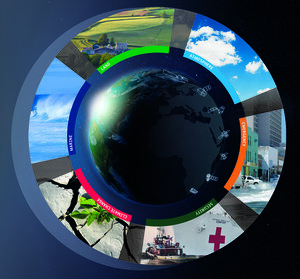
Copernicus Sentinel-1: making our seas safer
Within the first days of its operational life, the Sentinel-1A satellite has provided data for marine services in the Arctic.
During the first week of the satellite’s operational data supply, experts from the Technical University of Denmark and the Danish Meteorological Institute working under the Horizon 2020 MyOcean Follow-On project used the data to alert vessels on marine ice conditions.
The series of MyOcean projects is the pre-operational precursor of the Copernicus Marine Environment Monitoring Service, to be implemented by the European Commission. Its primary objective is to provide forecasts of the global marine environment and the near-realtime observation data necessary for forecast models.

Since Sentinel-1A data started to become free and accessible earlier this month with the satellite entering into its operational phase, the Danish Meteorological Institute began to use the information to improve observations of the polar regions and forecast maritime conditions.
The data are being used to produce ice charts, showing the details of ice conditions in a variety of regions, including the warnings of icebergs drifting in shipping routes.
The first ice chart from Sentinel-1A was produced in demonstration mode in April just weeks after launch, demonstrating the satellite’s capabilities for ice mapping at an early stage. Now that the satellite is operational, the mission will gradually become the backbone to the regular ice charting of Greenland waters.

The radar on Sentinel-1 can see through clouds and in the dark, making it the perfect tool for monitoring polar regions that are prone to bad weather and long periods of darkness.
The radar can distinguish between the thinner, more navigable first-year ice and the hazardous, much thicker multiyear ice to help assure safe year-round navigation in ice-covered Arctic and subarctic zones.
The mission also provides continuous sampling of the open ocean, offering information on wind and waves. This is useful for understanding interactions between waves and currents, forecast iceberg drift and improve efficiency for shipping. In addition, these observations can be used to track the paths of oil slicks and other pollution.

“There are a lot of expectations for Sentinel-1,” said Leif Toudal Pedersen, from the Danish Meteorological Institute.
“This mission will be the backbone of future ice charting and ice service provision, as well as sea ice science development.”
User-friendly, near-realtime access to Sentinel-1 data for marine users in polar regions is provided by PolarView and the DMI Centre for Ocean and Ice.
For more information on Sentinel-1A data access, click here.
The current MyOcean-Follow On H2020 project comprises 58 European public and private partners from 28 countries, and is led by Mercator Ocean.