Facts and figures
| Launch date |
Sentinel-3A: 16 February 2016 Sentinel-3B: 25 April 2018 |
| Launcher | Rockot, from Plesetsk, Russia |
| Orbit | Polar, Sun-synchronous at altitude of 815 km |
| Revisit time (ocean) | SLSTR ~1 day, OLCI ~2 days, SRAL has a 47 km ground track separation after 27 days – all cases using two- satellite constellation at the equator. |
| Life | Planned for seven years (carries consumables for 12 years) |
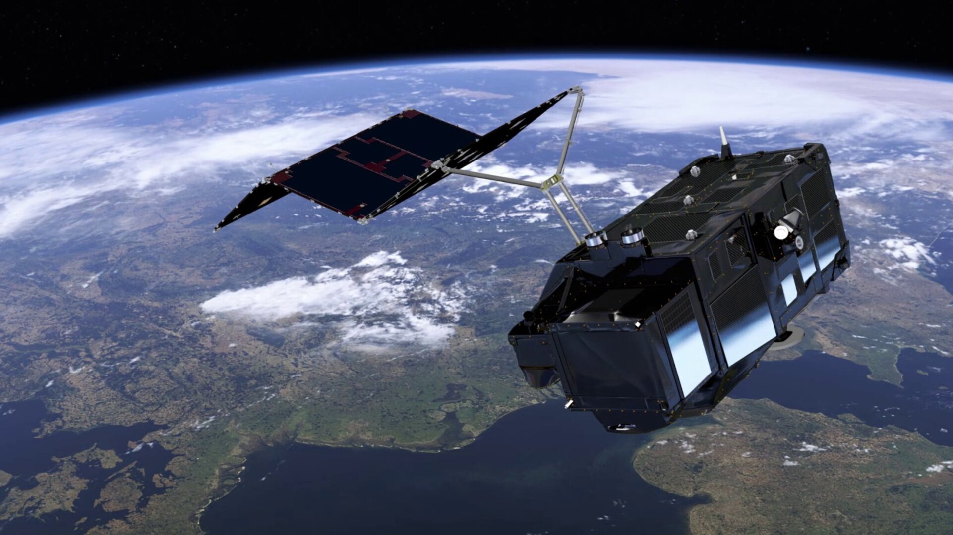
| Satellite | 2.2 m long, 2.2 m wide, 3.7 m high and a mass of 1150 kg (including 130 kg fuel) |
| Instruments | Ocean and Land Colour Instrument (OLCI) covering 21 spectral bands (400–1020 nm) with a swath width of 1270 km and a spatial resolution of 300 m Sea and Land Surface Temperature Radiometer (SLSTR) covering 9 spectral bands (550–12 000 nm), dual-view scan with swath widths of 1420 km (nadir) and 750 km (backwards), and a spatial resolution of 500 m for visible and near-infrared, and 1 km for thermal infrared channels Synthetic Aperture Radar Altimeter (SRAL) Ku-band (300 m after SAR processing) and C-band with a spatial resolution of approx 300 m Microwave Radiometer (MWR) dual frequency at 23.8 & 36.5 GHz |
| Receiving stations |
Scientific data: transmitted to core Sentinel ground stations Telemetry data: transmitted to and from Kiruna Sweden |
| Main applications | Sea-level change & sea-surface temperature mapping, water quality management, sea-ice extent and thickness mapping and numerical ocean prediction; land-cover mapping, vegetation health monitoring; glacier monitoring; water resource monitoring; wildfire detection; numerical weather prediction. |
| Mission | Developed by ESA, jointly operated by Eumetsat |
| Funding | ESA Member States and the European Union |
| Prime contractors | Thales Alenia Space France for satellite, OCLI & SRAL; Selex ES Italy for SLSTR; EADS-CASA for MWR |
| Data access | sentinels.copernicus.eu |


 Germany
 Austria
 Belgium
 Denmark
 Spain
Spain
 Estonia
 Finland
 France
 Greece
 Hungary
 Ireland
 Italy
Italy
 Luxembourg
 Norway
 The Netherlands
 Poland
 Portugal
 Czechia
 Romania
 United Kingdom
 Slovenia
 Sweden
 Switzerland


