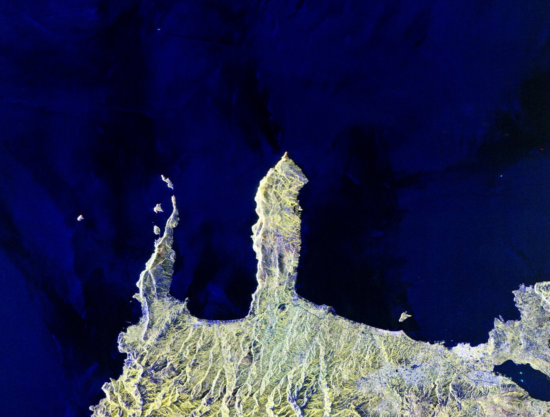
Earth from Space: Crete
This image shows northwestern Crete, the largest and most populous of the Greek islands, some 250 km long and 40 km wide.
Crete, which separates the Aegean and Libyan Seas in the eastern Mediterranean, is home to numerous beaches, fertile plateaus, caves and high mountains.
The island’s economy is predominantly based on agriculture, with significant vineyards, olive groves and citrus crops. Dairy is also very important, with a variety of sheep and goat cheeses available.
In the lower-right, the bright cluster of radar reflections on the northern coast is the city of Chania, the island’s second largest city after Heraklion (not pictured).
At the centre of the image is the Rodopou Peninsula. It is about 8 km long and 5 km wide. While the southern part of the peninsula is dotted with small villages, the northern part is practically uninhabited barring the shepherds.
Off the coast of the other peninsula to the left there are two small islands: Imeri Gramvousa to the south and Agria Gramvousa due north. Both are uninhabited, but the southern island hosts ruins of a Venetian fort and structures of Cretan insurgents in the 1820s – who resorted to piracy to survive.
This image is a compilation of three radar images from Japan’s ALOS satellite acquired on 28 August 2010, 13 October 2010 and the third band created by combining the other two.
This image is featured on the Earth from Space video programme.


 Germany
 Austria
 Belgium
 Denmark
 Spain
Spain
 Estonia
 Finland
 France
 Greece
 Hungary
 Ireland
 Italy
Italy
 Luxembourg
 Norway
 The Netherlands
 Poland
 Portugal
 Czechia
 Romania
 United Kingdom
 Slovenia
 Sweden
 Switzerland


