Germany
 Austria
 Belgium
 Denmark
 Spain
Spain
 Estonia
 Finland
 France
 Greece
 Hungary
 Ireland
 Italy
Italy
 Luxembourg
 Norway
 The Netherlands
 Poland
 Portugal
 Czechia
 Romania
 United Kingdom
 Slovenia
 Sweden
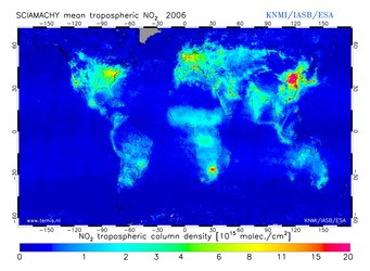
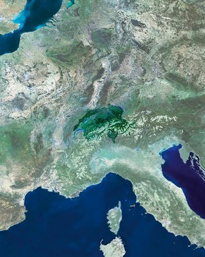
 Switzerland


Envisat still going strong after five successful years
Launched from Kourou in French Guiana on the night of 28 February 2002, ESA’s Envisat spacecraft marks its fifth year in space. Having orbited Earth more than
Generating some 280 Gigabytes of data products daily, Envisat has gathered 500 Terabytes to date. The amount of data returned by Envisat’s suite of 10 instruments is providing scientists with a global picture of our environment and is helping to fulfil the initial needs of the Global Monitoring for Environment and Security (GMES) initiative until the launch of the Sentinel satellites.
Results of ongoing research projects using data from Envisat, as well as other ESA satellites, will be presented at the 2007 Envisat Symposium in Montreux, Switzerland, from 23 to 27 April. This anniversary is particularly important because it marks the end of Envisat’s nominal lifetime, as the satellite was initially only intended to stay in orbit for five years. However, given the overall excellent standing of the satellite, the ESA Member States have agreed to fund the mission operations until 2010.
To mark five years of Envisat, four picture galleries have been created to provide an overview of the mission. Click on the images below to view.
Atmosphere
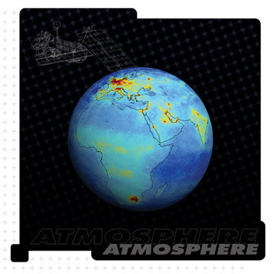
By observing changes in the Earth’s radiation budget, the depletion of the ozone layer, plumes of aerosols and pollutants and exhaust trails left in the atmosphere by airliners, Envisat supplies us with an accurate view of our atmosphere.
Land

By mapping the distribution of forests, agricultural land and human settlements and even tiny changes in surface elevation provoked by earthquakes or land subsidence, and monitoring vegetation characteristics, Envisat supplies us with an accurate view of our land.
Ocean

By monitoring critical indicators such as sea surface temperature, sea surface height and even tiny marine plankton, Envisat supplies us with an accurate view of our oceans. It is able to track illegal fisheries and oil slicks pollution as well as detect ocean eddies and currents.
Ice

By charting alterations in response to climate, looking for warning signs of changes in snow or ice reflectivity (known as 'albedo') and accurately measuring both ice extent and glacier velocity, Envisat supplies us with an accurate view of our cryosphere.