About ESA
The European Space Agency (ESA) is Europe’s gateway to space. Its mission is to shape the development of Europe’s space capability and ensure that investment in space continues to deliver benefits to the citizens of Europe and the world.
Highlights


Latest


Space in Member States
Find out more about space activities in our 23 Member States, and understand how ESA works together with their national agencies, institutions and organisations.
 Germany
 Austria
 Belgium
 Denmark
 Spain
Spain
 Estonia
 Finland
 France
 Greece
 Hungary
 Ireland
 Italy
Italy
 Luxembourg
 Norway
 The Netherlands
 Poland
 Portugal
 Czechia
 Romania
 United Kingdom
 Slovenia
 Sweden
 Switzerland
Science & Exploration
Exploring our Solar System and unlocking the secrets of the Universe
Go to topicAstronauts


Latest


Enabling & Support
Making space accessible and developing the technologies for the future
Go to topicLatest


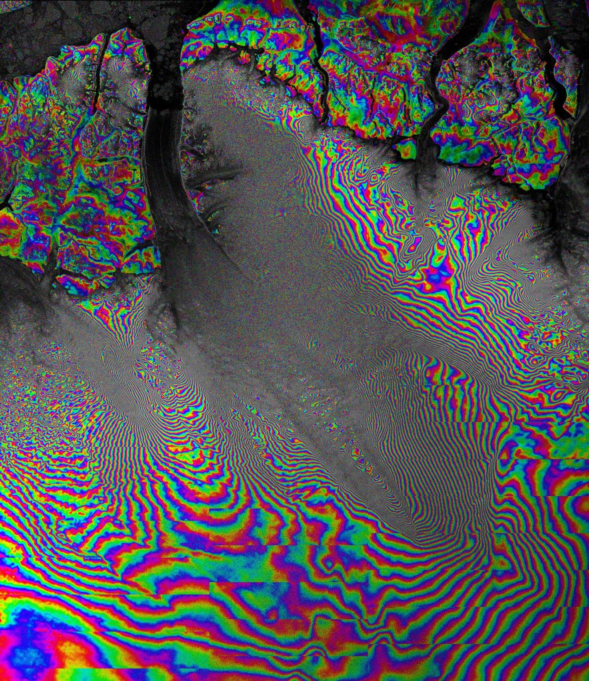
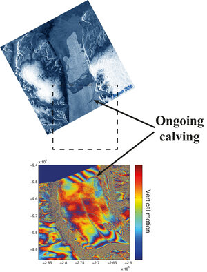
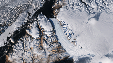
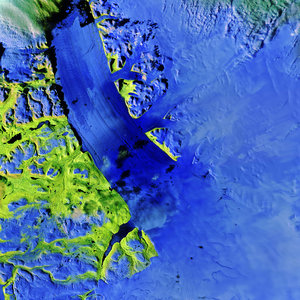
Petermann on the move
This ‘interferogram’ shows Petermann Glacier grinding towards the sea along the northwestern coast of Greenland. Two Radarsat-2 TOPS images acquired 24 days apart were used to generate it. Radarsat-2 was programmed specially by MDA to work in an experimental imaging mode called Terrain Observation by Progressive Scans (TOPS) in azimuth to match the way ESA’s Sentinel-1 will image Earth.
Synthetic Aperture Radar Interferometry – or InSAR – is a technique where two or more satellite radar images acquired over the same area are combined to detect large-scale surface changes. Small changes on the ground cause changes in the radar signal phase and lead to rainbow-coloured fringes in the interferogram.
This image shows some stationary and relatively slowly moving features, as well as some large areas of much faster moving ice. The interferometric fringes are widely spaced in the stationary areas and closer together in the centre of the glacier where the ice is moving much faster.