About ESA
The European Space Agency (ESA) is Europe’s gateway to space. Its mission is to shape the development of Europe’s space capability and ensure that investment in space continues to deliver benefits to the citizens of Europe and the world.
Highlights


Latest


Space in Member States
Find out more about space activities in our 23 Member States, and understand how ESA works together with their national agencies, institutions and organisations.
 Germany
 Austria
 Belgium
 Denmark
 Spain
Spain
 Estonia
 Finland
 France
 Greece
 Hungary
 Ireland
 Italy
Italy
 Luxembourg
 Norway
 The Netherlands
 Poland
 Portugal
 Czechia
 Romania
 United Kingdom
 Slovenia
 Sweden
 Switzerland
Science & Exploration
Exploring our Solar System and unlocking the secrets of the Universe
Go to topicAstronauts


Latest


Enabling & Support
Making space accessible and developing the technologies for the future
Go to topicLatest


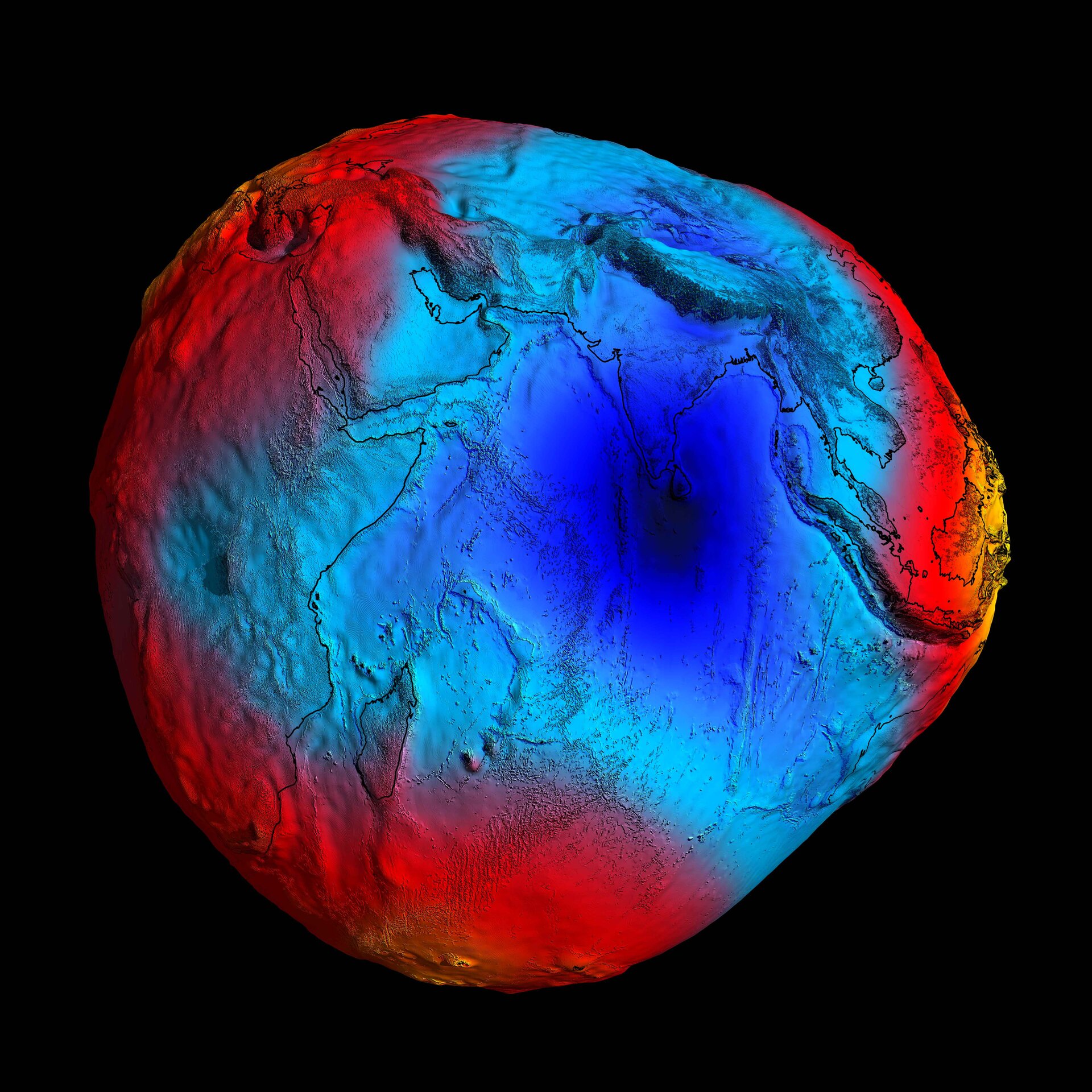
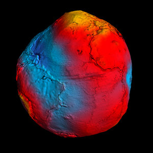
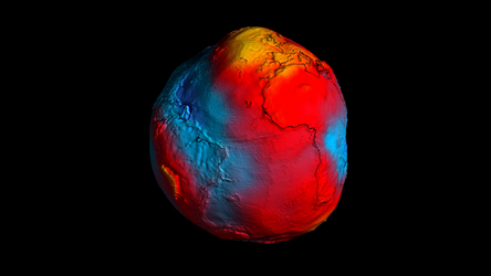
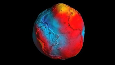
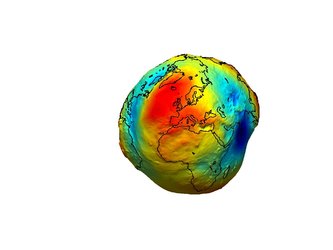
2011 GOCE geoid
In 2011, GOCE delivered a model of the 'geoid' pictured here. At the time, it was the most accurate ever produced. The colours in the image represent deviations in height (–100 m to +100 m) from an ideal geoid. The blue shades represent low values and the reds/yellows represent high values.
A precise model of Earth's geoid is essential for deriving accurate measurements of ocean circulation, sea-level change and terrestrial ice dynamics. The geoid is also used as a reference surface from which to map the topographical features on the planet. In addition, a better understanding of variations in the gravity field will lead to a deeper understanding of Earth's interior, such as the physics and dynamics associated with volcanic activity and earthquakes.
By the middle of 2014, no less than five gravity field models and corresponding geoids had been generated from GOCE's data. Each version more accurate than the last. The fifth gravity model and geoid, includes all of the gravity data collected throughout the lifetime of the mission – right up until November 2013 when the satellite finally stopped working and succumbed to the force it was designed to measure.