About ESA
The European Space Agency (ESA) is Europe’s gateway to space. Its mission is to shape the development of Europe’s space capability and ensure that investment in space continues to deliver benefits to the citizens of Europe and the world.
Highlights


Latest


Space in Member States
Find out more about space activities in our 23 Member States, and understand how ESA works together with their national agencies, institutions and organisations.
 Germany
 Austria
 Belgium
 Denmark
 Spain
Spain
 Estonia
 Finland
 France
 Greece
 Hungary
 Ireland
 Italy
Italy
 Luxembourg
 Norway
 The Netherlands
 Poland
 Portugal
 Czechia
 Romania
 United Kingdom
 Slovenia
 Sweden
 Switzerland
Science & Exploration
Exploring our Solar System and unlocking the secrets of the Universe
Go to topicAstronauts


Latest


Enabling & Support
Making space accessible and developing the technologies for the future
Go to topicLatest


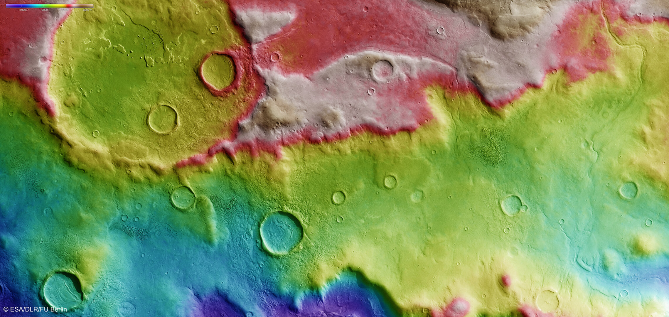
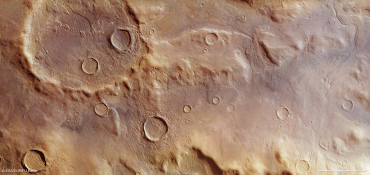
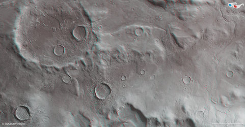
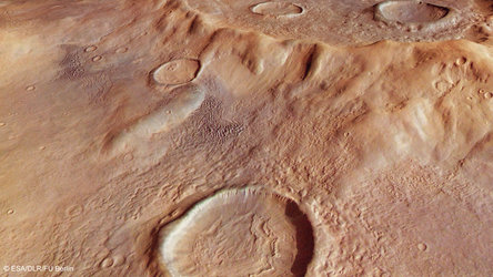
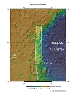
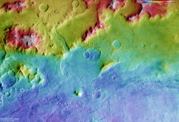
Hellespontus Montes topography
This is a colour-coded topography map of a portion of the western rim of the Hellas basin. The crater shown in the upper left is on the periphery of this larger impact basin. The edge of the Hellas basin is traced by a string of rocky peaks known as the Hellespontus Montes – revealed as the red/white ridge in this topography map thanks to their height. White and red show the highest terrains, while blue and purple show the deepest.
The image is based on a digital terrain model of the region, from which the topography of the landscape has been derived. The image was created using data acquired with the High Resolution Stereo Camera on ESA’s Mars Express on 13 January 2014 during orbit 12 750. North is to the right, east is up.