About ESA
The European Space Agency (ESA) is Europe’s gateway to space. Its mission is to shape the development of Europe’s space capability and ensure that investment in space continues to deliver benefits to the citizens of Europe and the world.
Highlights


Latest


Space in Member States
Find out more about space activities in our 23 Member States, and understand how ESA works together with their national agencies, institutions and organisations.
 Germany
 Austria
 Belgium
 Denmark
 Spain
Spain
 Estonia
 Finland
 France
 Greece
 Hungary
 Ireland
 Italy
Italy
 Luxembourg
 Norway
 The Netherlands
 Poland
 Portugal
 Czechia
 Romania
 United Kingdom
 Slovenia
 Sweden
 Switzerland
Science & Exploration
Exploring our Solar System and unlocking the secrets of the Universe
Go to topicAstronauts


Latest


Enabling & Support
Making space accessible and developing the technologies for the future
Go to topicLatest


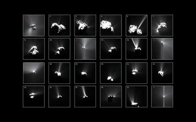
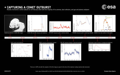
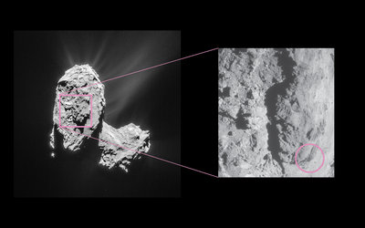
Summer outburst sources
Locations of the summer outbursts observed by Rosetta’s OSIRIS (blue dots) and NavCam (red dots) between July and September 2015, superimposed on a regional map of Comet 67P/Churyumov–Gerasimenko. Insets highlight the topography and terrain for a selection of outbursts (note that some locations can be seen in multiple insets from different angles).
Many outbursts occur at distinct boundaries, for example along terraced landforms between Anuket and Sobek (top centre); in pits and niches in Maftet and Wosret (top right); and along the boundary between Anhur and Aker (bottom right and left). Anhur in particular is weakly consolidated and shows a variety of niches, alcoves, boulders and debris indicating this region is susceptible to mass-wasting and cliff collapse, leading to exposure of volatile-rich materials that trigger outbursts.
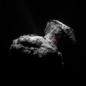
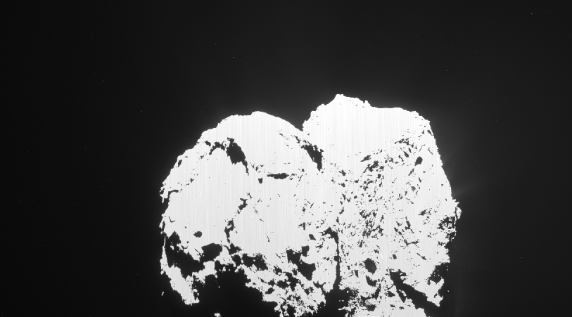
Clockwise, the images were taken by the OSIRIS narrow-angle camera on 1 May 2016 from a distance of 18 km; 27 January 2016 from 76 km; 2 May 2016 from 18 km; and 23 January 2016 from 76 km, respectively.
The numbers correspond to the outburst events identified in this image.