About ESA
The European Space Agency (ESA) is Europe’s gateway to space. Its mission is to shape the development of Europe’s space capability and ensure that investment in space continues to deliver benefits to the citizens of Europe and the world.
Highlights


Latest


Space in Member States
Find out more about space activities in our 23 Member States, and understand how ESA works together with their national agencies, institutions and organisations.
 Germany
 Austria
 Belgium
 Denmark
 Spain
Spain
 Estonia
 Finland
 France
 Greece
 Hungary
 Ireland
 Italy
Italy
 Luxembourg
 Norway
 The Netherlands
 Poland
 Portugal
 Czechia
 Romania
 United Kingdom
 Slovenia
 Sweden
 Switzerland
Science & Exploration
Exploring our Solar System and unlocking the secrets of the Universe
Go to topicAstronauts


Latest


Enabling & Support
Making space accessible and developing the technologies for the future
Go to topicLatest


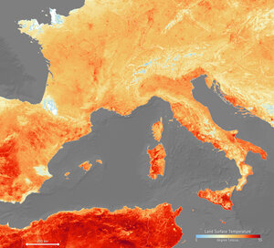
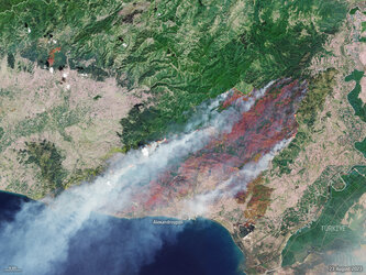
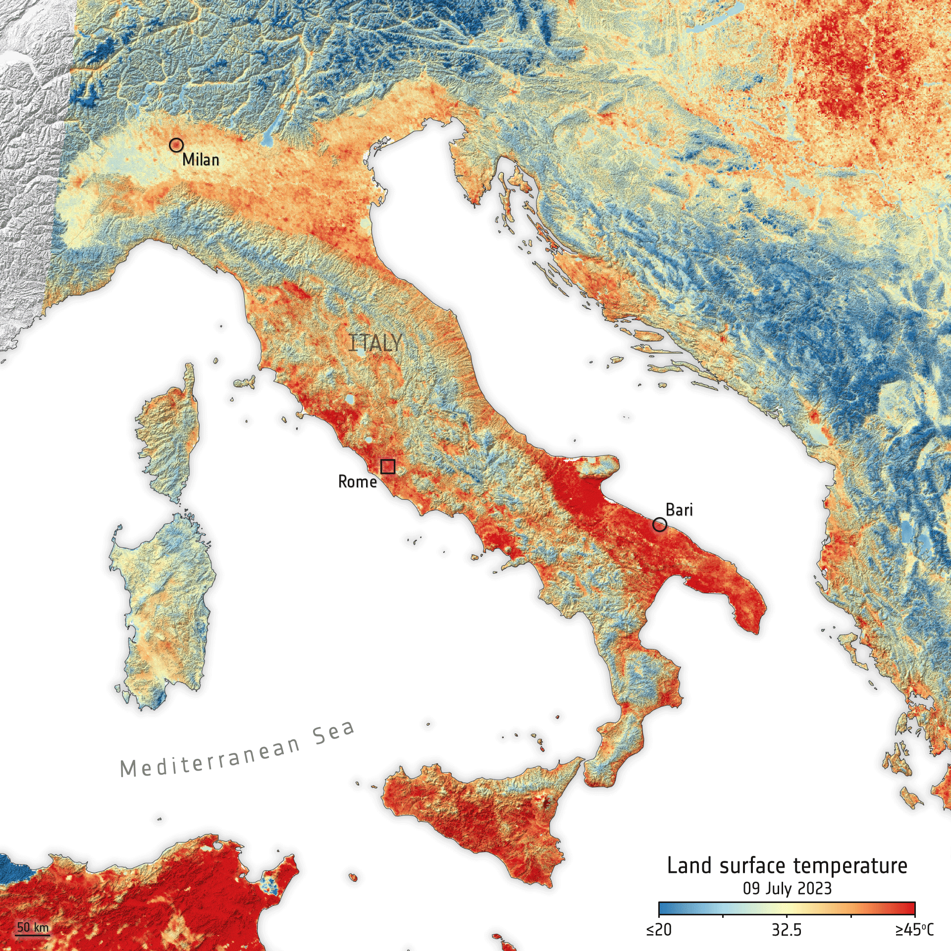
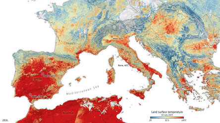
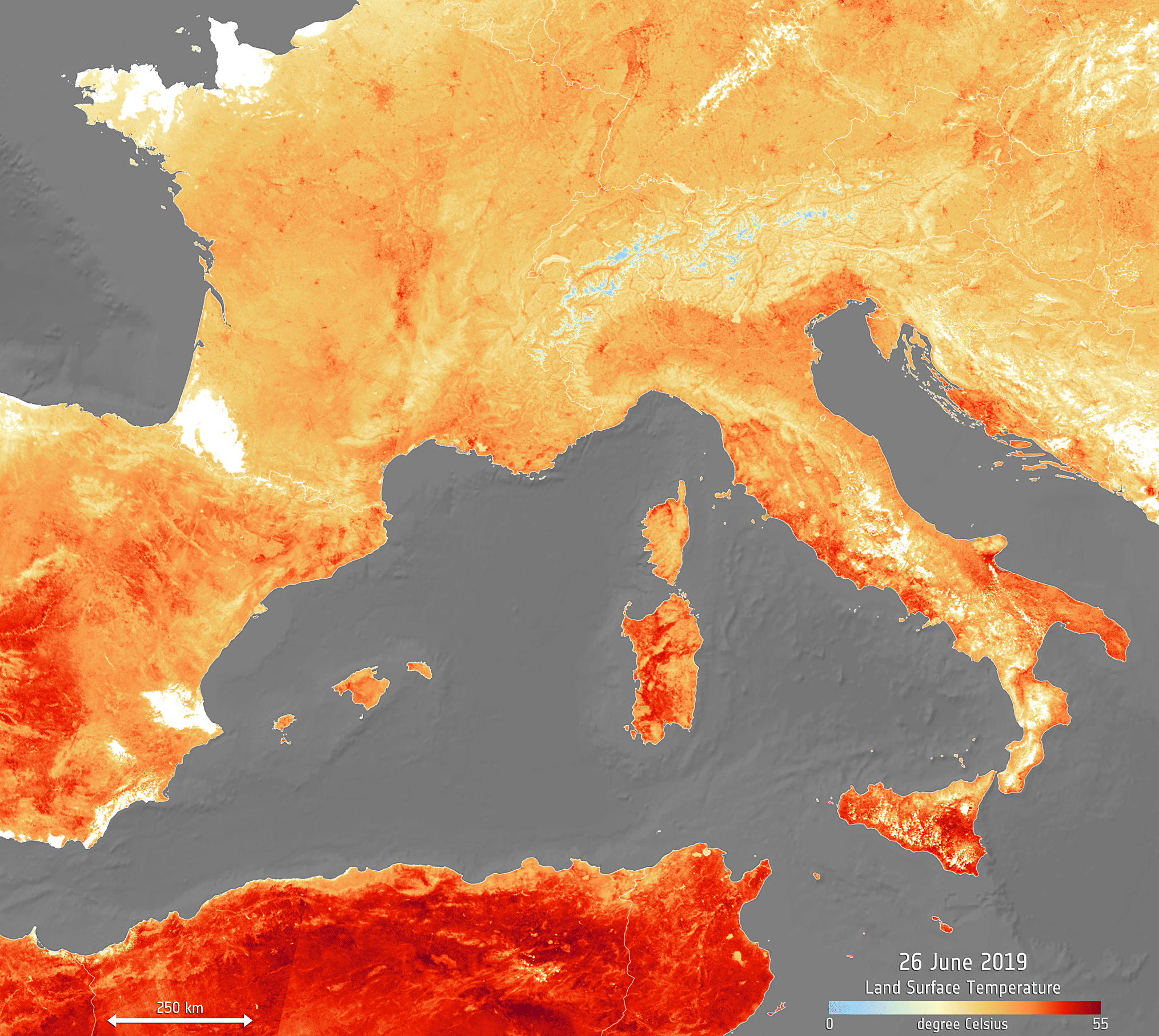
Sweltering southern Europe
Southern Europe is in the grip of a relentless heatwave, fuelling wildfires and water shortages. Information from the Copernicus Sentinel-3A satellite has been used to map the sweltering heat across the region.
The map shows that on 7 August 2017, temperatures of the land surface rose above 40°C – not an usual occurrence over the last weeks. Much of Italy, including Rome, Naples, Florence, Sardinia and Sicily has been suffering these highs. With numerous towns and cities on the ministry of health’s maximum heat alert, the Italians have aptly dubbed the heatwave ‘Lucifer’. Extreme temperatures have also been recorded in Spain and Portugal, the Balkans and Greece.
As well as wildfires and water shortages, the heat has also led to some tourist attractions being closed, ill health and even some fatalities, and the drought is also threatening crops.
The map uses data from the satellite’s Sea and Land Surface Temperature Radiometer, which measures energy radiating from Earth’s surface in nine spectral bands – the map therefore represents temperature of the land surface, not air temperature which is normally used in forecasts. The white areas in the image are where cloud obscured readings of land temperature.