About ESA
The European Space Agency (ESA) is Europe’s gateway to space. Its mission is to shape the development of Europe’s space capability and ensure that investment in space continues to deliver benefits to the citizens of Europe and the world.
Highlights


Latest


Space in Member States
Find out more about space activities in our 23 Member States, and understand how ESA works together with their national agencies, institutions and organisations.
 Germany
 Austria
 Belgium
 Denmark
 Spain
Spain
 Estonia
 Finland
 France
 Greece
 Hungary
 Ireland
 Italy
Italy
 Luxembourg
 Norway
 The Netherlands
 Poland
 Portugal
 Czechia
 Romania
 United Kingdom
 Slovenia
 Sweden
 Switzerland
Science & Exploration
Exploring our Solar System and unlocking the secrets of the Universe
Go to topicAstronauts


Latest


Enabling & Support
Making space accessible and developing the technologies for the future
Go to topicLatest


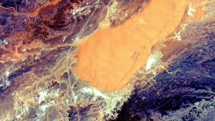
Sahara snow
The Copernicus Sentinel-2 mission has captured rare snowfall in northwest Algeria, on the edge of the Sahara desert.
Part of the Sahara was covered with snow on 7 January 2018, despite the desert at times being one of the hottest places on Earth. The snow was reported to be up to 40 cm thick in some places. Although temperatures plummet during the night, snowfall is very unusual in the Sahara because the air is so dry. It is only the third time in nearly 40 years that this part of the desert has seen snow.
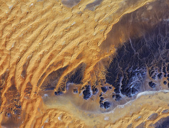
Most of the snow had melted by the end of the next day, but luckily the Sentinel-2A satellite happened to be in the right place at the right time to record this rare event from space. The image was acquired on 8 January.
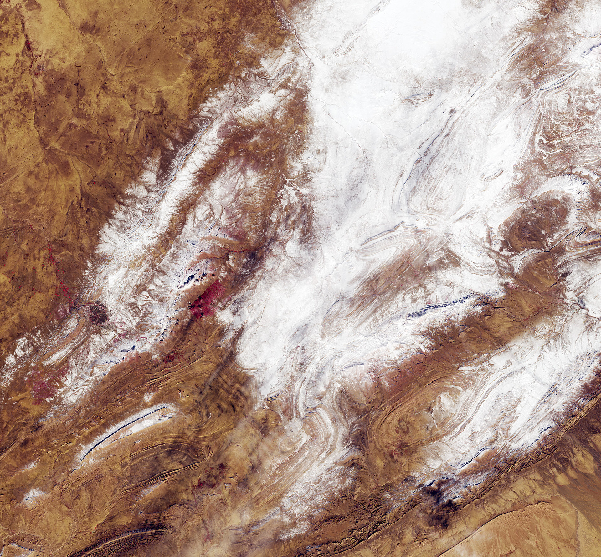
While snow is common in the High Atlas Mountains, the image shows that, unusually, snow fell on the lower Saharan Atlas Mountain Range. The image is dominated by the orange–brown dunes and mountains dusted with snow.
The town of El Bayadh can be seen towards the bottom left. To the east of El Bayadh, a cultivated forest is visible as a red rectangle. The image, which has been processed to display vegetation in red, shows that there is very little flora in the region.
The two Copernicus Sentinel-2 satellites each carry a high-resolution camera that images Earth’s surface in 13 spectral bands. The mission is largely used to track changes in Earth’s land and vegetation, so useful for monitoring desertification.
This image is featured on the Earth from Space video programme.