About ESA
The European Space Agency (ESA) is Europe’s gateway to space. Its mission is to shape the development of Europe’s space capability and ensure that investment in space continues to deliver benefits to the citizens of Europe and the world.
Highlights


Latest


Space in Member States
Find out more about space activities in our 23 Member States, and understand how ESA works together with their national agencies, institutions and organisations.
 Germany
 Austria
 Belgium
 Denmark
 Spain
Spain
 Estonia
 Finland
 France
 Greece
 Hungary
 Ireland
 Italy
Italy
 Luxembourg
 Norway
 The Netherlands
 Poland
 Portugal
 Czechia
 Romania
 United Kingdom
 Slovenia
 Sweden
 Switzerland
Science & Exploration
Exploring our Solar System and unlocking the secrets of the Universe
Go to topicAstronauts


Latest


Enabling & Support
Making space accessible and developing the technologies for the future
Go to topicLatest


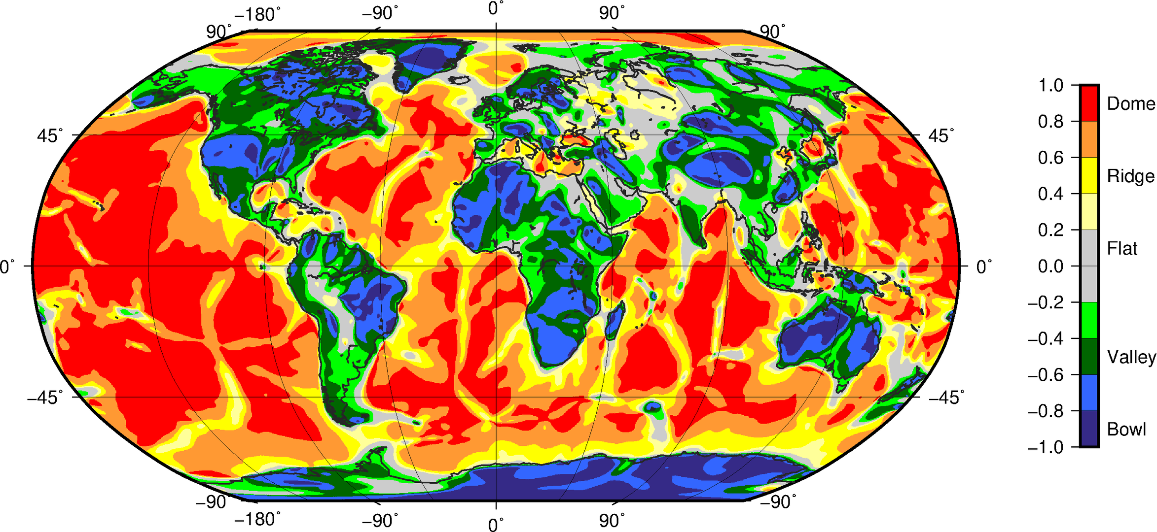
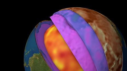
GOCE’s global tectonic map
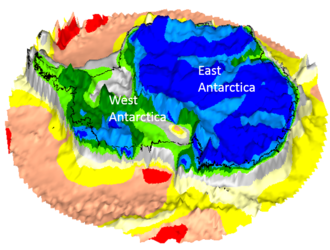
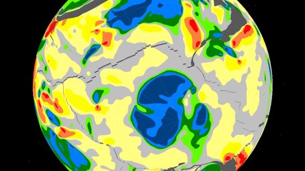
This global tectonic map was created by researchers from Kiel University and the British Antarctic Survey using gravity gradients – the rate of change in the pull of gravity in different directions – measured by ESA’s GOCE gravity-mapping satellite. These gravity gradients were used to create a curvature-based shape index, analogous to contour lines on a map, which can be interpreted as a tectonic map of the Earth, as seen by GOCE. Surface topography is stripped away to reveal the deep structure of the continents and oceans. Geological similar tectonic domains can exhibit distinct differences in satellite gravity gradients maps, which point to differences in the lithosphere – the solid crust and the molten mantle beneath. In combination with seismological results, gravity-gradient imaging offers a new window on Earth’s structure. In this project, for the first time, seismological models and satellite observations are integrated to provide a consistent image of the crust and upper mantle in 3D, needed to understand the coupling of plate tectonics and mantle dynamics. In remote frontiers like the Antarctic continent, where even basic knowledge of lithospheric scale features remains incomplete, the curvature images help unveil the heterogeneity in lithospheric structure, e.g. between the composite East Antarctic Craton and the West Antarctic Rift System.
Read full story: ESA’s gravity-mapper reveals relics of ancient continents under Antarctic ice