About ESA
The European Space Agency (ESA) is Europe’s gateway to space. Its mission is to shape the development of Europe’s space capability and ensure that investment in space continues to deliver benefits to the citizens of Europe and the world.
Highlights


Latest


Space in Member States
Find out more about space activities in our 23 Member States, and understand how ESA works together with their national agencies, institutions and organisations.
 Germany
 Austria
 Belgium
 Denmark
 Spain
Spain
 Estonia
 Finland
 France
 Greece
 Hungary
 Ireland
 Italy
Italy
 Luxembourg
 Norway
 The Netherlands
 Poland
 Portugal
 Czechia
 Romania
 United Kingdom
 Slovenia
 Sweden
 Switzerland
Science & Exploration
Exploring our Solar System and unlocking the secrets of the Universe
Go to topicAstronauts


Latest


Enabling & Support
Making space accessible and developing the technologies for the future
Go to topicLatest


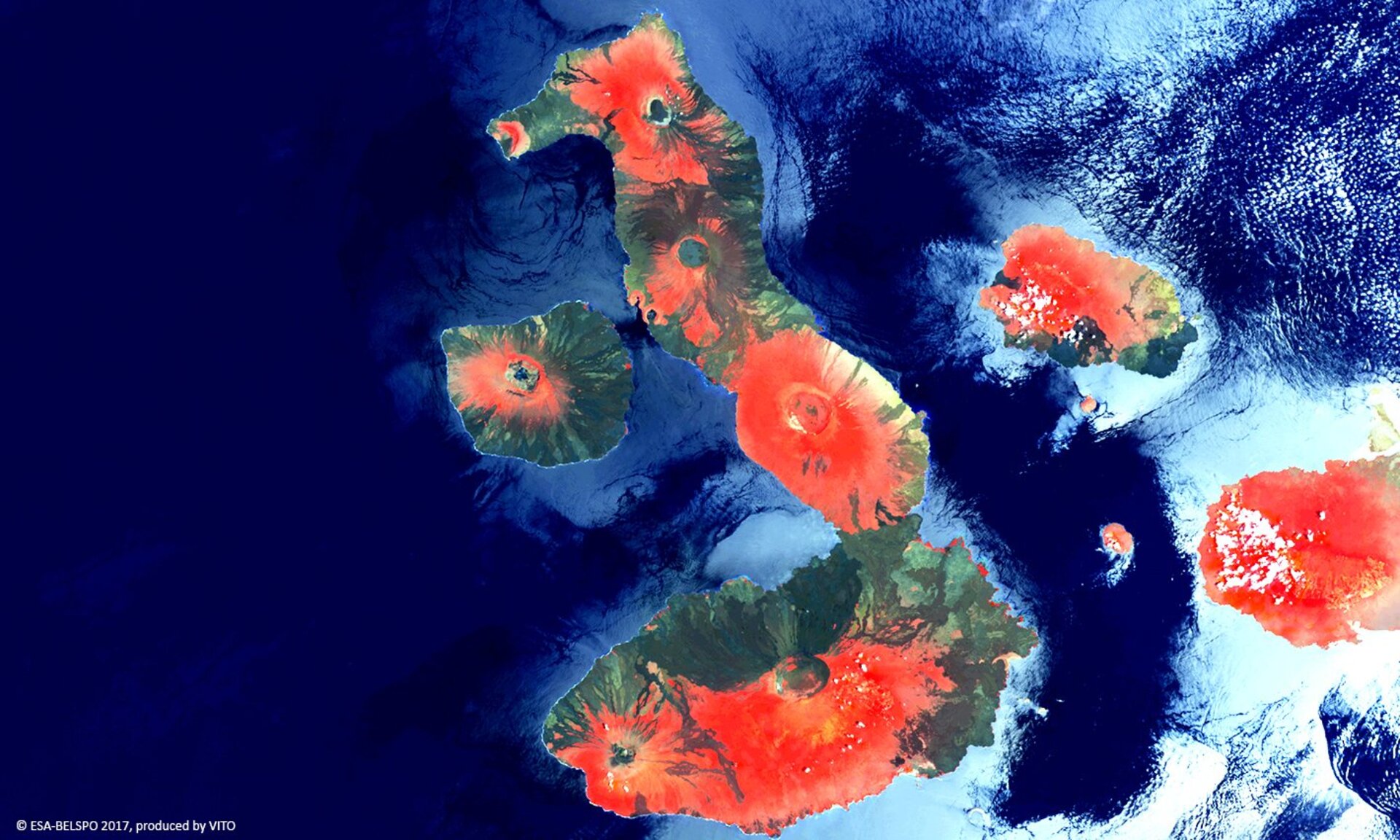
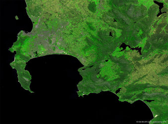
Proba-V view of Galápagos
A Proba-V view of the internationally protected, volcanic archipelago of the Galápagos and its surrounding marine reserve. This island chain is renowned for its many endemic species that were studied by Charles Darwin, directly contributing to his famous theory of evolution by means of natural selection.
In 1535, the Spaniard Tomás de Berlanga, fourth bishop of Panama, first visited these islands by chance when he was sailing to Peru. On the maps of Mercator and Ortelius, famous geographers, the islands were named Insulae de los Galopegos or Islands of the Tortoises after the giant tortoises found there.
This false colour composition highlights vegetation in red on the flanks of several volcanoes, in particular Wolf, Darwin, Alcedo, Santo Tomás and Cerro Azul volcanoes on Isla Isabella, the largest island.
Launched on 7 May 2013, Proba-V is a miniaturised ESA satellite tasked with a full-scale mission: to map land cover and vegetation growth across the entire planet every two days.
Its main camera’s continent-spanning 2250 km swath width collects light in the blue, red, near-infrared and mid-infrared wavebands at a 300 m pixel size, down to 100 m in its central field of view.
VITO Remote Sensing in Belgium processes and then distributes Proba-V data to users worldwide. An online image gallery highlights some of the mission’s most striking images so far, including views of storms, fires and deforestation.
This 100 m spatial resolution image was acquired on 27 February 2017.