Space up your app with satellite data
Calling all app developers: register today for the opportunity to spend a week at ESA developing news ideas and concepts for mobile apps using satellite Earth observation data.
During 8–15 September, ESA will welcome 20 app developers to its ESRIN centre for Earth observation in Frascati, Italy, for the third ESA App Camp.
The selected participants will learn how to bring Earth observation data – particularly coming from the European Copernicus environment-monitoring programme – to the everyday user through smartphones.
Data from the new Sentinel-1A satellite will also be made available for use during the App Camp. Sentinel-1 is the first satellite mission dedicated to the Copernicus programme, and employs an advanced radar that can see through clouds and in the dark.
This type of data opens new possibilities for apps in a variety of areas such as agriculture, emergency response, environmental protection and maritime transportation.
ESA will provide participants with access to satellite data they can use in creating functional app prototypes (for Android or iOS). Experience in integrating Earth observation data is not a prerequisite to participate.
Applicants can choose from various categories and apply either alone or as a team of up to four people. The selection of participants will be based on previous programming work and experience. Travel and accommodation expenses will be covered by ESA.
Apply for the 2014 App Camp. Applications will be accepted until 21 July.
App Camp success

The ‘Cheetah – Taking on a Billion-dollar Problem in Africa’ app developed at last year’s App Camp went on to win the ESA App Challenge in the Copernicus Masters competition.
This app combines crowdsourcing with Earth observation data to assist in global food security, focusing on the production and transportation of crops in Africa.
The Cheetah team is now in talks with partners in Africa about starting field testing. Discussions are also under way on the team’s potential acceptance into the start-up programme of one of the ESA Business Incubation Centres.
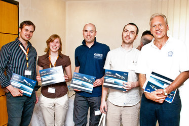
Last month, a different app camp – called Space App Camp – was held at ESA’s Technical Centre in Noordwijk, the Netherlands.
Participants were asked to come up with working app prototypes using data from Europe’s Galileo/EGNOS satellite navigation systems along with Copernicus data.
The winning app, ‘FieldSense’, helps farmers to visualise up-to-date crop health data, allowing them to manage their evaluation time and crop treatments better.
The Space App Camp was hosted by the Sustainable Services for Copernicus and Global Navigation Satellite Systems in Mobile and Mobility project, which supports innovative mobile service providers in taking advantage of Galileo and EGNOS and data derived from Copernicus.


