Earth from Space: Adeus, Amazon
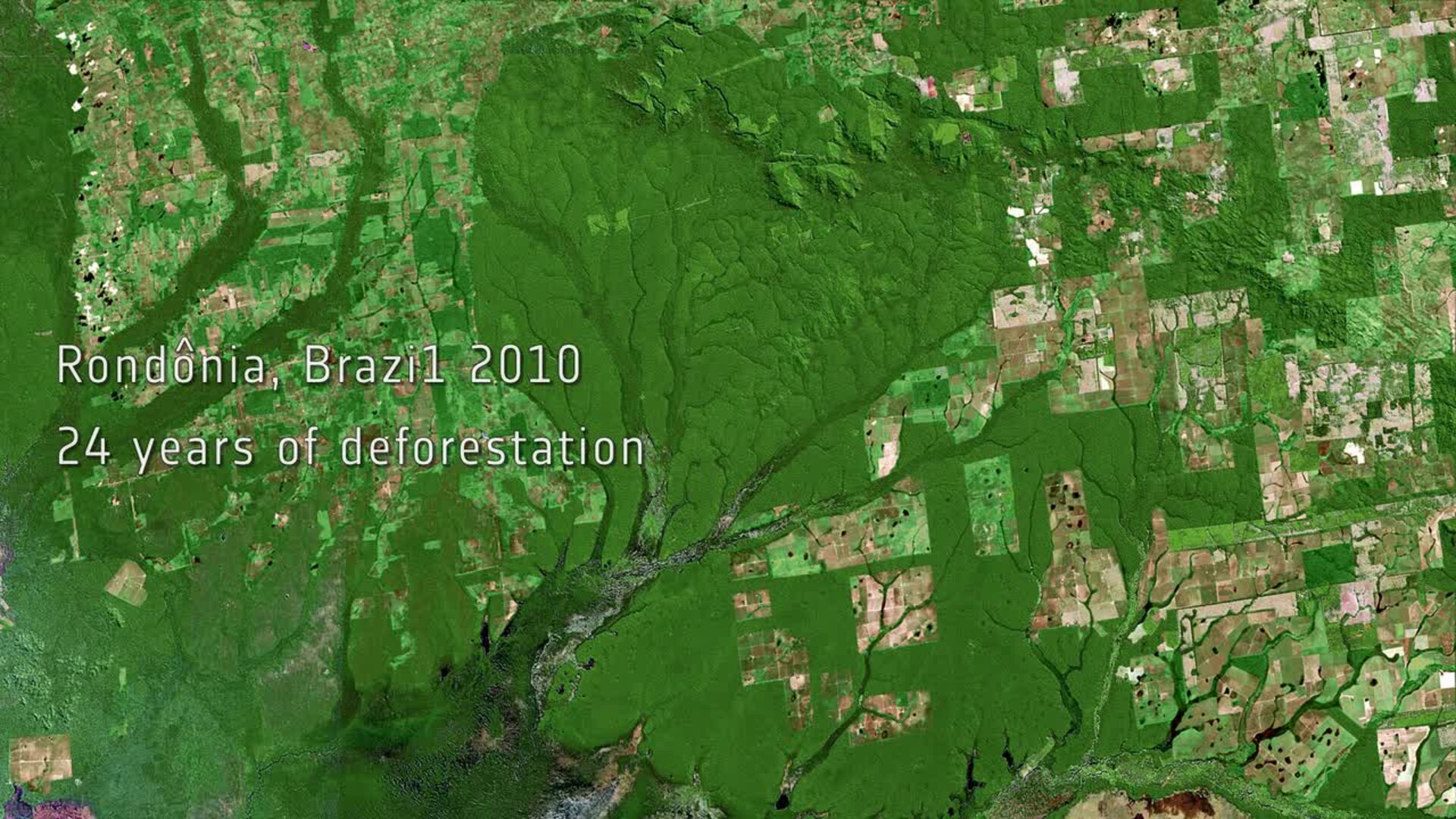
This animation shows deforestation of the Amazon Rainforest in the western Brazilian state of Rondônia from 1986 to 2010.
While the central area remains green and untouched, squares of light green and brown pop up over time as the forest is cut away.
Rondônia’s forest zone is one of the areas most affected by deforestation in Brazil. Over half of the state has been deforested since intensive settlement and logging began in the 1970s.
Rainforests worldwide are being destroyed at an alarming rate. This is of great concern because they play an important role in global climate, and are home to a wide variety of plants, animals and insects. More than a third of all species in the world live in the Amazon Rainforest.
Unlike other forests, rainforests do not grow back when they are destroyed and, owing to their composition, their soils are not suitable for long-term agricultural use.
With their unique view from space, Earth observation satellites have been instrumental in highlighting the vulnerability of the rainforests by documenting the scale of deforestation, particularly in remote areas.
The animation was created using two cloud-free images: the first from NASA’s Landsat mission in 1986, and the second from the Spanish Deimos mission in 2010.
The changes over time were simulated by referring to other satellite data acquired during the 24 years between the two images.
The Image of the Week is featured on ESA Web-TV, broadcast online every Friday at 10:00 CEST.


