Using space to foster development assistance for disaster resilience
ESA’s Global Development Assistance Programme, brought to life by ESA Member States at Space19+, has officially kicked off its first action focused on agile Earth observation information development in the thematic sector of ‘Disaster Resilience’. This marks the first milestone in a programme that aims to foster impact through the systematic integration of Earth observation data in development projects.
According to the World Bank, more than a third of the world’s poor live in areas affected by multiple types of natural hazards. Aside from facing an increased frequency and intensity of hazards, developing countries sometimes have substantial data gaps which undermine decision-makers and development practitioners from making appropriate investments for risk reduction and mitigation.
By allowing objective, timely and precise observations continuously covering large spatial areas anywhere on the globe, Earth observation is an advantageous tool which can support the different phases of disaster management such as risk reduction, alert and response. “Earth observation information helps us to understand the level of exposure to risk we have in a region, as well as assess what happens after a disaster,” stated Anna Wellenstein, World Bank Regional Director for Sustainable Development in Latin America and the Caribbean.
Earth observation can predict and anticipate certain risks such as floods or storms notably through the use of high frequency meteorological satellites and high-resolution low Earth orbit satellites such as the Sentinel missions of the Copernicus programme. Moreover, it helps to better understand slow-onset events like droughts, since it allows monitoring changes over certain periods of time and identify trends.

It can also assist the evaluation of potential impacts in the event of a natural disaster and assess the vulnerability of a population to multiple risks. It also provides emergency responders and information on damaged areas right after a disaster strikes, through mechanisms such as the International Charter Space and Major Disasters and the Copernicus Emergency Management Service (EMS). Earth observation can also support reconstruction and response efforts to disasters through rapid damage assessments, or by monitoring the progress of reconstruction efforts.
In the Disaster Resilience domain, the Global Development Assistance programme’s main focus is on hazard, exposure and vulnerability mapping in order to better meet International Financial Institutions’ and development stakeholders’ information requirements. To achieve this, ESA engages a consortium of nine European specialised Earth observation providers to partner with the World Bank and the Asian Development Bank, aiming to strengthen developing countries’ disaster resilience. These include providers from Spain, Italy, Luxembourg, Austria, Germany, the Czech Republic and the UK.
This is done by focusing on “knowledge development through the generation of new pre-operational technical products and services in direct response to requirements identified by the Development Banks, the Banks’ clients and stakeholders in developing countries,” explains Christoph Aubrecht, Global Development Assistance Programme Coordinator at ESA.
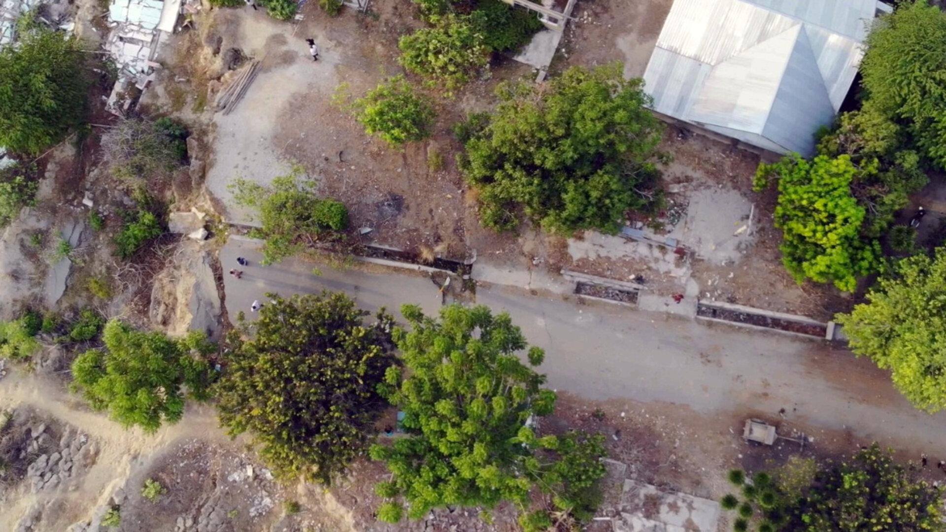
Specifically, developments are planned to enhance Earth observation products concerning both hydrometeorological hazards, geohazards and related risks. For instance, Earth observation techniques based on Synthetic Aperture Radar (SAR) images are being used to identify terrain deformation trends and hotspots such as subsidence areas, in order to better mitigate landslide and subsidence related risks which affect a lot of people living below the poverty line in developing countries.
This service is particularly useful in urban environments where informal settlements, slums and uncontrolled urban sprawl often happen to be in areas at risk of land and mudslides.


Access the video
Another example of an Earth observation product being developed through the Global Development Assistance programme concerns floods, which according to the World Health Organization, affected more than two billion people worldwide between 1998 and 2017. By combining optical and SAR images, it is possible to observe and monitor the spatial extent of floods and infer geo-information about the hazard and its impact.
These activities are part of the new, joint Space for International Development Assistance Initiative (Space for IDA) set up by ESA in partnership with International Financial Institutions – namely the World Bank and the Asian Development Bank.
Aside from Disaster Resilience, the operational needs of ESA’s International Financial Institution partners across a wide range of additional thematic sectors will also be addressed through targeted agile Earth observation information developments in the GDA programme.

These thematic domains include: Urban Sustainability; Climate Resilience; Fragility, Conflict and Security; Marine Environment and Blue Economy; Agriculture; Water Resources; and Clean Energy, which correspond to key development priorities identified by International Financial Institutions and at the same time represent domains where satellite data can be particularly impactful. This will facilitate data-driven and informed decision-making for key stakeholders.
“It is really critical to be able to base investment decisions on a strong body of evidence about what is happening on the ground, and, in this regard, Earth Observation technologies […] are critical to ensure that we have this layer of information on which to base policies” explained Sameh Wahba, Global Director of the Urban, Disaster Risk Management, Resilience and Land Global Practice at the World Bank.
"The Asian Development Bank is increasingly applying Earth observation data and products in the design and implementation of projects across the region. We hope enhanced cooperation with agencies such as ESA and Earth observation service providers will lead to strengthened capacity among our developing member countries to better exploit the potential of geoinformation for sustainable development,” commented Nessim Ahmad, previously Deputy Director General of the Asian Development Bank’s Regional and Sustainable Development Department.
“The European Space Agency is critical for the success of our projects on the ground” added Asian Development Bank Managing Director General Woochong Um.


