
Applications
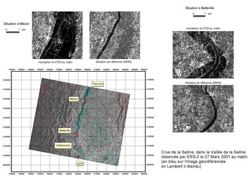
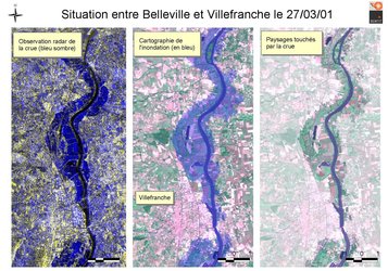
Map of Saône valley showing flooding
A map of the Saône valley from Tournus (North), Mâcon and Belleville to Villefranche (South), derived from radar images. The flood extent is represented in blue and some enbankments clearly emerge from the flood along the river. Use of standard French projection system (Lambert étendu) means that this map is directly comparable to a topographic map. Photo: ESA/SERTIT.


