Agency
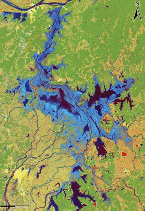
ERS SAR multi-temporal image of Jiangsu Province
SAR multitemporal (red, green, blue) image of Jiangsu Province in China, including rice growing areas. As part of the joint ESA-China Dragon Programme, new techniques for rice mapping are being explored, using multitemporal, dual polarisation, narrow and wide swath ASAR data applied to large provinces in China. Rice yield prediction models with inputs from both ASAR and MERIS data will be tested.