
Agency
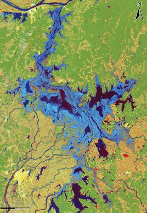
Monitoring Suriname floods
Suriname has been affected by severe flooding caused by torrential rains since 1 May 2006. This map, over the area south of Paramaribo to Pr. Van Blommestein Meer, was developed by GMES RESPOND when the International Charter "Space and Major Disasters" was activated and shows potentially affected flooded areas as derived from satellite imagery (Envisat, Landsat, Spot 5).
(Copyrights - Spot data: CNES; Envisat data: ESA; LANDSAT data: USGS & Maryland GLCF; VMAP data: NGA)


