
Climate change deforestation, Brazil
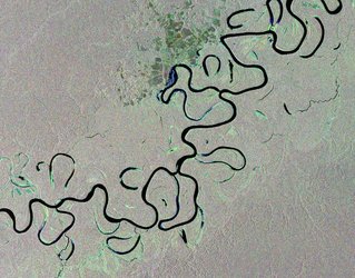
The Xingu River, which flows within the Amazon Basin of central-eastern Brazil, is shown in this Envisat image, which highlights the contrast between the rainforest and sprawling urbanisation.
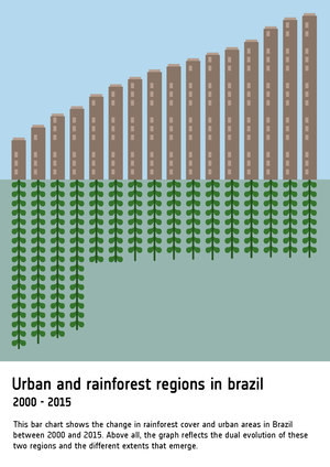
Urbanisation has increased all over the world with people moving away from rural areas to towns and cities. Brazil has a relatively high level of urbanisation with an estimated 8 out of 10 people living in cities – roughly 144 million out of 180 million.
This growth needs to be monitored to ensure it proceeds on a sustainable basis, does not damage environmental resources and does not worsen the quality and life and safety of urban dwellers.
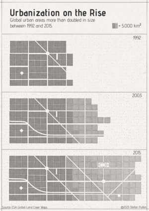
Earth Observation-derived maps of land use change show how cities expand over time. In the field of risk management, satellite imagery can characterise urban environments to a degree of accuracy simply not available on the ground.


