
Agency
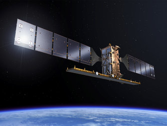
Global monitoring - Sentinel-2
ESA is preparing the Sentinel satellites as part of the EU’s Global Monitoring for the Environment and Security initiative.
Sentinel-2 is a polar-orbiting, multispectral high-resolution imaging mission for GMES land monitoring to provide, for example, imagery of vegetation, soil and water cover, inland waterways and coastal areas.
Data from Sentinel-2 will benefit services in areas such as land managment by European and national public institutes, the agricultural industry and forestry as well as disaster control and humanitarian relief operations. Images of extreme events such as floods, volcanic eruptions and landslides will also be acquired by Sentinel-2.


