Agency
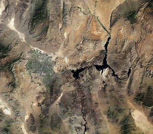
White ring shows drop in water levels
An 11-year drought and population growth have resulted in a decline in Lake Mead’s water levels. In October 2010, the lake – located along the border of the US states of Arizona and Nevada – fell to its lowest level (330m above sea level) since it was filled 75 years ago.
This aerial view taken on 9 April 2010 shows the white ring around the shoreline that indicates a drop in water levels. The ring is from mineral deposits left behind by water when levels were higher.