MAVinci UAV in operation
ESA-supported German company MAVinci offers satellite-quality remote sensing at ultra-high resolution, down to a matter of centimetres.
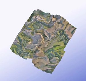
Like many good things, it comes in a box: an easy-to-assemble Unmanned Aerial Vehicle (UAV) with a wingspan of less than two metres that can deliver upwards of 2000 geolocated images per flight.
The propeller-driven Sirius produces visible, near-infrared and 3D images – and takeoff is simply a matter of throwing it into the air.
MAVinci’s own autopilot controls the aircraft from takeoff to landing, using precision satnav to image along a programmed track, with automated air traffic monitoring to avoid any collision risk.
To guarantee safety, a human pilot follows the plane’s progress, standing ready to take over the controls at any time.
Originally hosted at ESA’s Business Incubation Centre in Darmstadt in Germany, MAVinci received technical support from ESA engineers on camera calibration, attitude determination and the exploitation of satnav data.
MAVinci’s UAVs have found uses all over the world, from tracking erosion canyons in Spain’s Andalusia region to surveying open-cast coal mines in Australia, from creating a database of cemeteries in the Czech Republic, to tracking crop damage in Germany for insurance purposes.