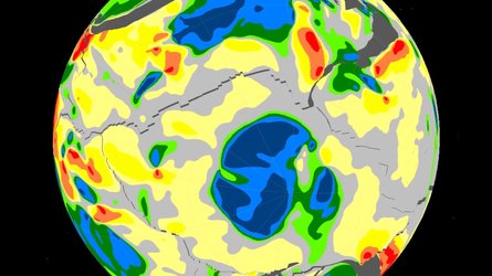

GOCE map of Antarctica on bedrock topography
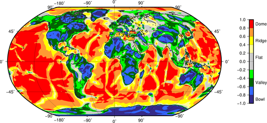
Gravity gradient shape index map of Antarctica draped on bedrock topography, derived from GOCE data. In remote frontiers like the Antarctic continent, where even basic knowledge of lithospheric scale features remains incomplete, GOCE’s new curvature images help unveil the difference in lithospheric structure between the dense craton composite of East Antarctica and the rift system of West Antarctica. These enhanced satellite gravity gradient images provide tantalising new insights for lithosphere and large-scale tectonic studies in the least understood continent on Earth. These enhanced images can additionally be used to understand the evolution of the plate tectonic evolution of the Antarctic region and Earth in general. The blue colours indicate ‘bowl’ features and the red colours indicate ‘dome’ features, see also GOCE’s global tectonic map image.
Read full story: ESA’s gravity-mapper reveals relics of ancient continents under Antarctic ice


