
Applications
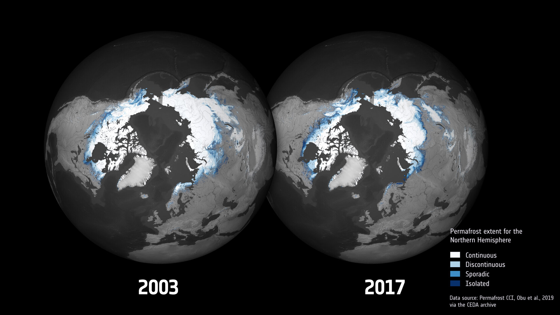
Permafrost extent for the northern hemisphere
Maps produced by ESA’s Climate Change Initiative are providing new insights into thawing permafrost in the northern hemisphere. This image shows permafrost extent in 2003 compared to 2017. Continuous permafrost is defined as a continuous area with frozen material beneath the land surface, except for large bodies of water. None-continuous permafrost is broken up into separate areas and can either be discontinuous, isolated or sporadic. It is considered isolated if less than 10% of the surface has permafrost below, while sporadic means 10%-50% of the surface has permafrost below, while discontinuous is considered 50%-90%.


