Applications
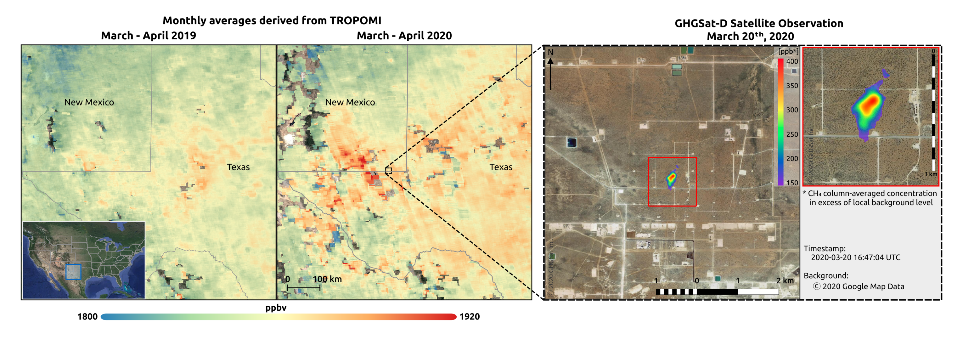
Methane concentrations over the Permian Basin
GHGSat uses data from the Copernicus Sentinel-5P satellite to detect emission hotspots in various regions – including the Permian Basin. The image on the left shows the enhanced methane concentrations over the Permian basin, while the image on the right highlights the exact facility in the Permian Basin leaking methane.
Read more: Detecting methane emissions during COVID-19
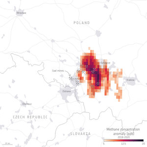
GHGSat methane concentrations over a coal mine in th…
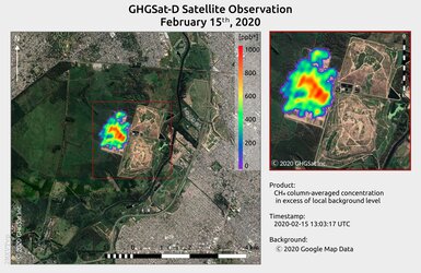
Methane from landfill site in Argentina imaged by GH…

Averaged methane concentrations over Buenos Aires ob…

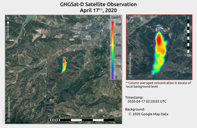
Methane concentrations near Cheltenham