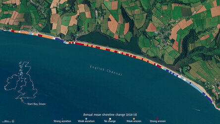
Applications
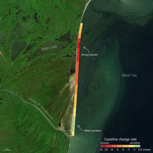
Shoreline changes along the coast of Malgrat de Mar, Spain
This image shows the shoreline changes along the coast of Malgrat de Mar, Spain. Areas of erosion between 1994 and 2019 are visible in red, while areas of accretion between 1994 and 2019 are visible in blue. The 1994 coastline data is extracted from US Landsat data while the 2019 data is from the Copernicus Sentinel-2 mission.
Read full story: Measuring shoreline retreat