
Applications
Soil moisture June 2022 northern Italy
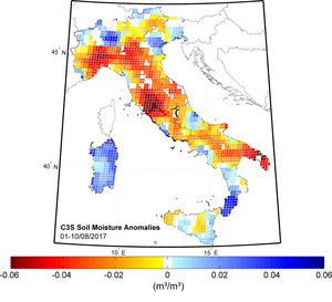
We are all aware that the summer of 2022 has been one of the hottest on record, causing drought and raging wildfires in many parts of Europe. Satellite data have been used to report the baking temperatures of the land surface and map fires, but the Copernicus Sentinel-1 radar mission has also been used to zoom in and provide very high-resolution measurements of the actual moisture content of the surface soils. Maps of northern Italy, for example, show how dry this summer has been compared to two years ago.


