
EarthCARE multispectral imager
The EarthCARE satellite carries four instruments, one of which is the multispectral imager.
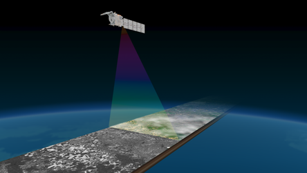
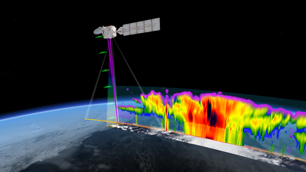
The multispectral imager collects images over a wide swath projected onto Earth’s surface. These images provide context to help interpret the measurements made by EarthCARE’s two active instruments, the lidar and the radar, that collect information only from a thin curtain under the satellite, and to extend that information into 3D scenes.
The multispectral imager also provides scene spectral property information for the broadband radiometer observations, allowing it to correct for the effects of its own instrument response and derive scene radiance more accurately. Furthermore, some aerosol information is directly derived from the multispectral imager.
The multispectral imager comprises two cameras that are both mounted on a common bench and use shared electronics and control units. The views from the cameras project a wide swath on Earth’s surface, which is tilted to the left side of satellite nadir to minimise the number of pixels affected by glint from the Sun.
Read more about EarthCARE’s instrument package


