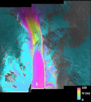
ERS-1: First Images.

A selection of the first ERS-1 SAR images, acquired on the 27th July 1991. Also includes unique Meteosat images of the total eclipse of the Sun, as seen by satellite.
begin
00:02:29:00 ESA opening sequence
00:02:49:00 title sequence: ERS-1 European Remote Sensing Satellite
00:03:00:00 Frisian Islands, the Netherlands. Image acquired at Fucino, Italy, 27th July, 1991. 95km by 95km [image processed by ESA/EARTHNET]
00:03:23:00 Frisian Islands, the Netherlands. These lines are the wake of various ships, some of which extend for up to 20 kms [ESA/EARTHNET]
00:03:39:00 Frisian Islands, the Netherlands. Here the difference in land use can be seen clearly. Such is the detail that different crop types can be identified [ESA/EARTHNET]
00:03:55:00 Frisian Islands, the Netherlands. The water pattern is the most remarkable feature. The difference in colour is due to surface roughness. When the surface is flat it appears dark; brightness indicates a choppy sea [ESA/EARTHNET]
00:04:11:00 Spitzbergen, Norway. This is a part of the Svalbard Archipelago. 95km by 95km [Kiruna Salmijarvi]
00:04:26:00 Spitzbergen, Norway. High mountains and glaciers dominate this landscape [Kiruna Sal