Copernicus Sentinel-6 in action
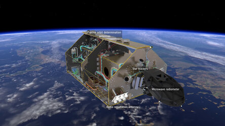
The Copernicus Sentinel-6 Poseidon-4 dual-frequency (C- and Ku-band) radar altimeter uses an innovative interleaved mode that has improved performance compared to previous satellite altimeter designs.
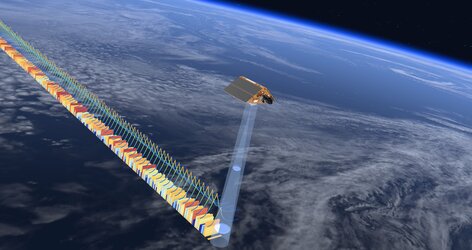
The Sentinel-6 radar altimeter derives its height above Earth by measuring the time it takes for a transmitted radar pulse to reflect off Earth’s surface. Over the ocean, the returned echo pulse provides a waveform. The shape of the waveform is used to determine the sea-surface height from the radar range, the significant wave height, from the slope of the waveform leading edge, and the surface wind speed from the ocean roughness expressed by the power of the radar echo.
Unfocussed synthetic aperture radar processing exploits the Doppler characteristics of the return echoes. Synthetic azimuth beams are formed and steered to a specific location on Earth’s surface to build a stack of waveforms. By averaging the stack of waveforms, measurement noises are reduced and the along-track resolution is improved from several kilometres to about 300 m.
Radar pulses are transmitted and received using a new interleaved timing arrangement that allows conventional, low-resolution data to be acquired simultaneously with high-resolution delay-Doppler measurements.
The unique capability of the Copernicus Sentinel-6 Poseidon-4 altimeter is designed to ensure enhanced continuity with the long time series of measurements from the Topex Poseidon and Jason series of satellite altimeters.
Every 10 days, Sentinel-6 provides sufficient measurements to map the sea-surface height of the ocean from which sea-level rise can be computed. This gives the ‘big picture’ allowing us to chart the sea level with confidence.
Sentinel-6 provides both continuity and enhanced measurements for sea level, helping Copernicus deliver the best quality climate change evidence to make more confident decisions — every day.
Voice of Craig Donlon - ESA's Copernicus Sentinel-6 Mission Scientist


