
|
Exercice 1: Étude de l'ouragan Katrina du sommet des nuages aux vagues océaniques 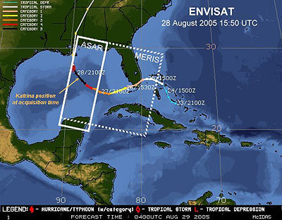 Chart showing acquisition locations for Envisat's MERIS and ASAR images. The MERIS image covers approximately 1200 by 1200 km, while the ASAR Wide Swath mode image covers approximately 415 by 1200 km. |