
|
Informazioni generali   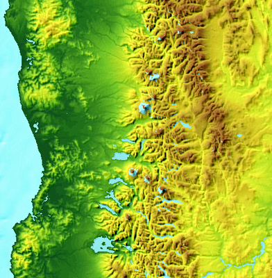 The elevation of the Andes is well displayed in the Digital Elevation Model (DEM) shown here. 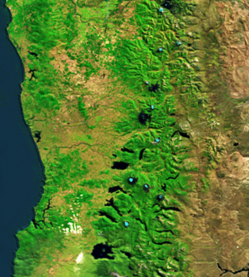 This figure shows dark blue lakes associated with rivers that originate from the volcanoes of the Andes Mountains. Snow-capped volcanic cones are shown in white. The green native forest is found in the wet western Andes Mountains. To the far east you can see the dry zone of Argentina. 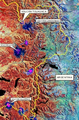 Landsat TM sensor image. False colour composite RGB, bands 4, 5, 3 (2007). |