 |
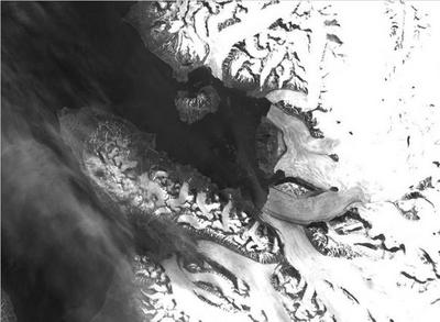
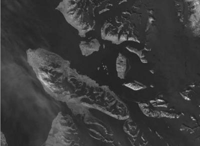
Beispiel  True colour satellite image of Brøggerhalvøya, Svalbard, Norway. The image was taken on 10 July 1999 using the Enhanced Thematic Mapper (ETM+) sensor on the Landsat satellite. Brøggerhalvøya on Spitsbergen is situated at about 79° N and 13° E in the North Atlantic Ocean. Spitsbergen is the biggest island in the archipelago of Svalbard. For location and scale see the GoogleEarth file location 3.1.  The image of the red channel (VIS band 3 of Landsat ETM+ in the graphic above) shows the reflection in the red part of the electromagnetic spectrum.  Image of the Near InfraRed channel (NIR, band 4 of Landsat ETM+ in the graphic above) shows the reflection in the NIR part of the electromagnetic spectrum. The human eye cannot see infrared directly.  Image of the ShortWave InfraRed channel (SWIR, band 5 of Landsat ETM+ in the graphic above) shows the reflection in the SWIR part of the electromagnetic spectrum.  The histogram shows the number of pixels (vertical axis) with a certain reflection (0-255; horizontal axis) in the red, NIR and SWIR channels. Most digital satellite cameras have an 8-bit resolution, which means they can resolve up to 256 different reflectance values per channel. The pixel values in the histogram therefore range between 0 (very dark, no ground reflection) and 255 (very bright, very strong ground reflection). Most pixels in the red channel show a very high reflection (255 or close to it, very bright), as can be seen from the image. This high reflection stems from snow and firn. The reflection in the NIR channel is much lower, with much less very bright pixels, as can be seen in the NIR image. The SWIR image contains mostly dark pixels and no very bright ones, because the reflectance of snow and ice is very low in the SWIR. |