|
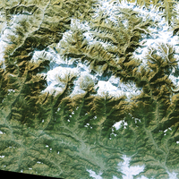
Annapurna Conservation Area
Go to the Exercises to work with the Case Studies dealing with the Annapurna area. Follow the directions given in the individual sections and learn how to use and work with satellite images. By doing this you will become familiar with high resolution satellite images and will be able to use this knowledge to organise your own case studies, using the images of other landscapes provided in the Resources section.
The Background section provides you with information on the Annapurna Conservation Area. Last update: 11 April 2013
| ||||||||||||||||||||||||||||||||||||||||||||||||||||||||||||||