
|
Radar à synthèse d'ouverture (RSO) 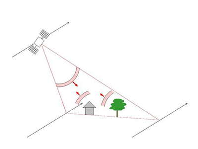  North is to the left. For location and orientation, see the GoogleEarth file location 3.3. 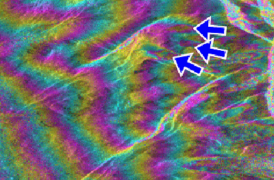 North is at the top, meaning the viewing direction from above is from left to right on the interferogram. The interferogram displays the phase differences as the distances from the satellite to the ground on 7 and 8 March 1996, as measured by the ERS SAR sensor. 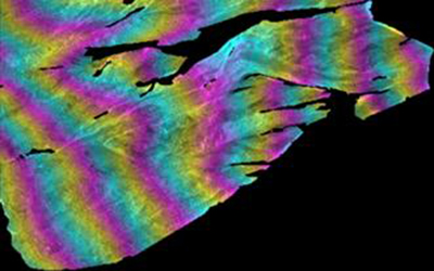 Black areas are removed because the terrain is too steep in these areas to be properly seen in the SAR images. 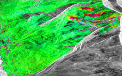 |