
This multi-temporal Synthetic Aperture Radar (SAR) image of Toulouse, in southwest France, is a composite of three separate ERS images:
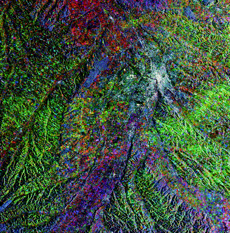
The scene covers an area of 70 km by 70 km. Near its centre is an agglomeration of bright spots, increasing in density towards the centre; they are representative of the city of Toulouse's degree of urbanisation.
ERS SAR imagery has proved to be very useful also for geomorphological mapping, with morphology being far better delineated than in images derived from traditional vertically observing optical sensors. Thecourses of the large valleys, which indicate a gentle gradient with meandering rivers, are clearly apparent. Surprisingly, the valley fringes are often marked by subtle but quite visible bright lines. They indicate some 5 20 m high steps in an otherwise flat landscape. To the west of the Garonne River, up to three such parallel bright lines can be observed, which mark the limits of alluvial terraces belonging to old, no longer active fluvial plains.
The landscape between the main valleys is gently undulating, rarely exceeding 400 m in elevation. Man-made structures - mainly buildings - appear as bright points, forming bright patches in the case of village sand towns. Industrial complexes in and around Toulouse itself are identified by larger bright spots, e.g. just south of the city centre, along the northern access and the 'Ateliers Aéronautiques', just south of the main Toulouse-Blagnac airport.
To the west of Toulouse, the forest of Bouconne appears in darker grey. The bright spot near the top centre is Grenade, whilst in the Save Valley, west of Toulouse, the town of L'Isle Jourdain is visible.
The colours in the image reflect changes in the structure (vegetation, etc.) or humidity of the ground. The uniform green aspect throughout can be explained by a day of rainy weather preceding the data acquisition of 7 August 1995. Wet vegetation and soil cause a higher return signal than on the other dates. The reddish colour is contributed by the January acquisition. Since the valleys are more affected by higher backscatter, it might be interesting to study the occurrence of local frost. The light blue (cyan) fields indicate a densely grown crop on both the May and August 1995 imaging dates, such as sunflowers, corn and another late crop.


 ESA Bulletin Nr. 84.