
Mars from horizon to horizon
On 2 June 2003, ESA’s Mars Express spacecraft headed off to explore our red-hued neighbouring planet. In the 15 years since, it has become one of the most successful missions ever sent to Mars. To mark this milestone comes a striking image of Mars from horizon to horizon, showcasing one of the most intriguing patches of the martian surface and demonstrating the capabilities of the groundbreaking mission.
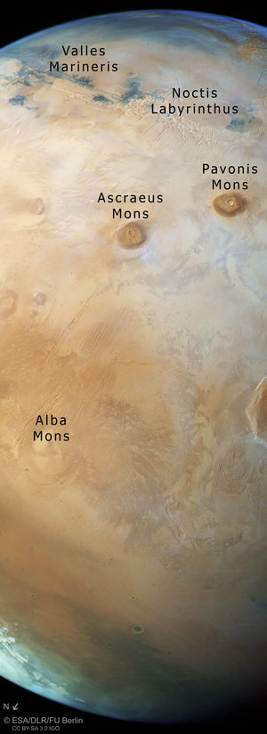
This view, taken by Mars Express’ High Resolution Stereo Camera, shows the region of Tharsis in all its glory. It sweeps from the planet’s upper horizon — marked by a faint blue haze at the top of the frame — down across a web of pale fissures named Noctis Labyrinthus, part of Valles Marineris, two out of four great volcanoes, and finishes at the planet’s northern polar ice cap (in this perspective, North is to the lower left).
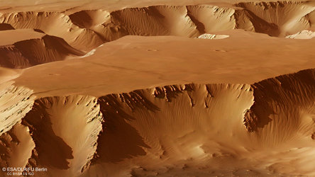
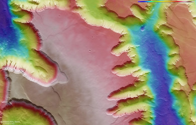
Tharsis was once an incredibly active region, displaying both volcanism and the shifting crustal plates of tectonics, and hosts most of the planet’s colossal volcanoes. Visible here are the volcanoes Pavonis Mons (top right), Ascraeus Mons (top middle), Alba Mons (to the bottom left), and a small sliver of Olympus Mons (to the lower right, continuing out of frame), the troughs and fissures that comprise the canyon system Valles Marineris, and the web-like Noctis Labyrinthus that sits at the canyon system’s western end.
This image was acquired by the HRSC on 12 October 2017 during Mars Express Orbit 17444. The ground resolution in the centre of the image is approximately 1 km/pixel and the images are centred at 245°E/25°N. The colour image was created using data from the HRSC’s nadir (aligned perpendicular to the surface of Mars) and colour channels.
This image with labels


