Galileo – a new tool for science
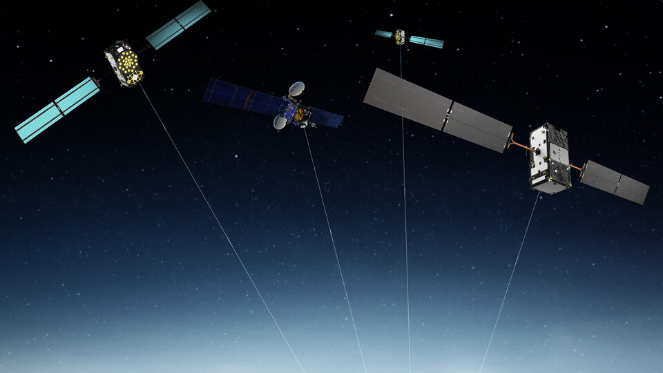
Every moment of every day, Europe’s constellation of Galileo navigation satellites that ring our planet transmits precisely shaped and timed signals, down through the atmosphere, reflecting back from Earth’s land, seas and ice and extending far out into space, as far as the Moon.

This ubiquity is a byproduct of Galileo’s goal to provide navigation services to all – but has also led to these signals becoming an important tool for scientific investigation of our environment, atmosphere, weather and even fundamental physics. Leading researchers will gather in Bulgaria this September to discuss the latest scientific uses of Galileo and other satnav systems – and you can register to join them.
The 8th International Colloquium on the Scientific and Fundamental Aspects of Global Navigation Satellite Systems will take place on 8–16 September in Sofia, Bulgaria, co-organised by ESA and Sofia University St. Kliment Ohridski.

“Measurement is a fundamental aspect of science, and the signals from Galileo and equivalent GNSS satellites represent an invaluable yardstick to hold against all kind of physical processes,” comments Javier Ventura-Traveset, Head of ESA’s Navigation Science Office and ESA Chair for this Colloquium.
“It is well known that fixed GNSS stations are used to monitor geological fault lines and volcanoes, and form the basis of terrestrial reference frames for measuring the precise shape of the Earth. And the occultation of GNSS signals – for instance through ‘rain fade’ – helps forecast the weather as well as the structure and trace gas constituents of the atmosphere.

“Reflected GNSS signals are also being employed for altimetry and remote sensing, soon to be tested by ESA’s PRETTY satellite, while the timing information embedded within the signals – accurate to a few billionths of a second – can be used for all kinds of scientific testing, including fundamental physics: a pair of Galileo satellites placed in an elliptical orbit delivered the most precise measurement ever of gravitational redshift, how changes in gravity affect the wavelength of light and we have also recently being able to measure orbital perturbations due to Einstein’s general relativity.”
“So scientists are eager to go on making increased use of GNSS as a tool for measurement and investigation, which has already go beyond our initial expectations as we will see with some highly original studies during our Colloquium. ESA’s Navigation Science Office aims to support them in this endeavour, coordinating through events such as September’s Colloquium. This unique worldwide event is a chance for researchers to share their results and future plans in this area.”

The Colloquium will also discuss in some detail the state of the art of Systems and technologies for navigation in space, such as the use of GNSS beyond terrestrial orbits or the development of dedicated systems for ‘exo-navigation’ on the Moon or Mars, as well as their scientific possibilities.
This edition will also include ‘transversal’ topics of interest to multiple fields, such as GNSS Big Data – compiling and analysing large quantities of satnav signal records – and Internet of Things positioning for science – the placement of tracking sensors on moveable items, floats or animals – as well as the use of GNSS-enabled autonomous vehicles such as drones and High-Altitude Pseudo-Satellites.

Scientific studies with the potential to improve the future performance of GNSS will also be highlighted, such as tropospheric and ionospheric corrections and ‘hybridisation’, looking into adding extra sensors to improve positioning precision and reliability and ‘precise orbit determination’ – ways of sharpening the precise knowledge of satellites’ position and motion through space.
For more information on the Colloquium, including how to register, click here.

Genesis project
The potential of GNSS is such that ESA is proposing a dedicated mission called Genesis as part of its Future NAV programme to its Council of Ministers at the end of this year. The Genesis mission will combine, for the first time ever, all space-based ‘geodetic’ (or Earth measuring) techniques aboard a single well-calibrated satellite, establishing precise and stable ties between them. Genesis will then become a true dynamic space geodetic observatory allowing to improve the realisation of the Terrestrial Reference Frame (TRF) – the single most precise model of Earth – towards the goal of achieving an accuracy of 1 mm and a long-term stability of 0.1 mm/yr.
Javier concludes: “The Terrestrial Reference Frame is the foundation for all space- and ground-based observations in Earth Science and Navigation and, therefore, Genesis will have a major significance since it will have an impact on multiple scientific and societal endeavours, from supporting a more accurate monitoring of several climate change essential variables to improve the orbit determination accuracy of all the GNSS satellites, to name two examples.”


 Germany
 Austria
 Belgium
 Denmark
 Spain
Spain
 Estonia
 Finland
 France
 Greece
 Hungary
 Ireland
 Italy
Italy
 Luxembourg
 Norway
 The Netherlands
 Poland
 Portugal
 Czechia
 Romania
 United Kingdom
 Slovenia
 Sweden
 Switzerland


