Aeolus winds now in daily weather forecasts
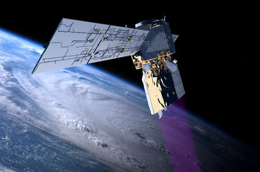
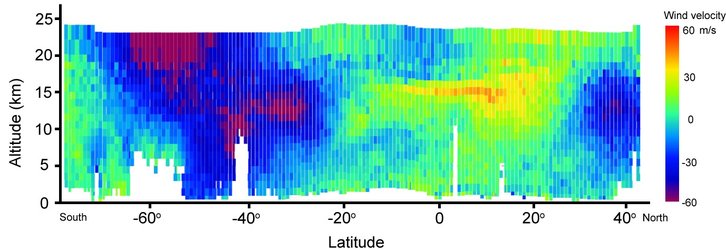
ESA’s Aeolus satellite has been returning profiles of Earth’s winds since 3 September 2018, just after it was launched – and after months of careful testing these measurements are considered so good that the European Centre for Medium-Range Weather Forecasts is now using them in their forecasts.
The decision to include new measurements in weather forecasts is never taken lightly; it takes a lot of work to understand the data properly and ensure that they are of good quality.
It is extremely unusual for a completely new type of satellite data to be ready for practical use in forecasts so soon after launch. Nevertheless, this extraordinary satellite has surpassed expectations and, as of today, Aeolus will be improving our forecasts, from one-day forecasts to those forecasting the weather more than a week ahead.
Boasting a number of ‘firsts’, Aeolus is the first satellite mission to provide profiles of Earth’s wind in cloud-free air globally, carries the first instrument of its kind, and uses a novel approach to measuring the wind from space.
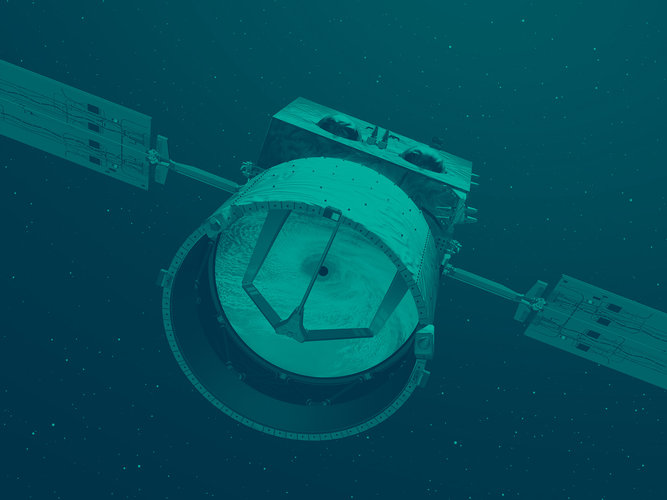
Its novel Doppler wind lidar instrument, which comprises a powerful laser, a large telescope and a very sensitive receiver, emits short, powerful pulses of ultraviolet light down into the atmosphere and measures the shifts in wavelength of the laser light scattering off molecules and particles moving in the wind.
Aeolus was designed to fill the lack of wind-profile measurements in the weather observation network and, therefore, to play a key role in increasing our understanding of the workings of the atmosphere, contribute to climate research and also improve weather forecasting.
Before forecasters could assimilate Aeolus’ data into weather forecasts, some serious testing and quality checks had to be done.

ESA’s Aeolus mission manager, Tommaso Parrinello, said, “During the first year of Aeolus’ life in orbit, ESA and the Aeolus Data Innovation Science Cluster team worked hard to characterise and calibrate this ground-breaking satellite instrument and understand exactly how it was working in space.
“They were helped by scientists across the world who compared wind measurements taken from the ground and from aircraft with those from Aeolus.
“While we did find that we had to switch to the instrument’s second laser transmitter to boost power, the mission is proving to be an excellent way of measuring the wind – so much so that we now see data being assimilated into forecasts, which we are absolutely thrilled about.”
Michael Rennie, from the European Centre for Medium-Range Weather Forecasts (ECMWF), explains, “We had to assess the impact that Aeolus would have on the weather forecasts before deciding to ingest them operationally – and this involved checking the data quality with the forecast and other observations, and running a host of experiments to see if Aeolus consistently improves the forecasts, and by how much.

“Our experiments showed that, indeed, Aeolus had a positive impact, and this makes a big difference, particularly over parts of the world where there is a lack of other wind observations.
“The biggest improvement is in tropical regions and in the southern hemisphere. We also see that measurements from Aeolus are among the most important instruments in space for forecast quality, which is hugely impressive considering that Aeolus actually gives us less than 1% of the measurements we use in daily forecasts.”
With the operational assimilation of Aeolus data at ECMWF, a major milestone for this novel mission has been reached. Other operational weather centres across the world are also seeing positive impact of Aeolus observations and plan to start assimilating data during the course of this year.
This mission milestone also paves the way for a possible future fleet of operational Doppler wind lidar satellites in space.


 Germany
 Austria
 Belgium
 Denmark
 Spain
Spain
 Estonia
 Finland
 France
 Greece
 Hungary
 Ireland
 Italy
Italy
 Luxembourg
 Norway
 The Netherlands
 Poland
 Portugal
 Czechia
 Romania
 United Kingdom
 Slovenia
 Sweden
 Switzerland


