Germany
 Austria
 Belgium
 Denmark
 Spain
Spain
 Estonia
 Finland
 France
 Greece
 Hungary
 Ireland
 Italy
Italy
 Luxembourg
 Norway
 The Netherlands
 Poland
 Portugal
 Czechia
 Romania
 United Kingdom
 Slovenia
 Sweden
 Switzerland


Future of Copernicus Expansion Missions secured
The Copernicus Sentinel Expansion Missions are a major leap forward in Europe’s Earth observation capabilities. With the United Kingdom’s re-entry to the EU’s Copernicus programme, funding has been confirmed to complete the development of all six Copernicus Sentinel Expansion Missions, as discussed this week during the International Astronautical Congress taking place in Milan, Italy.
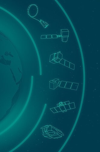
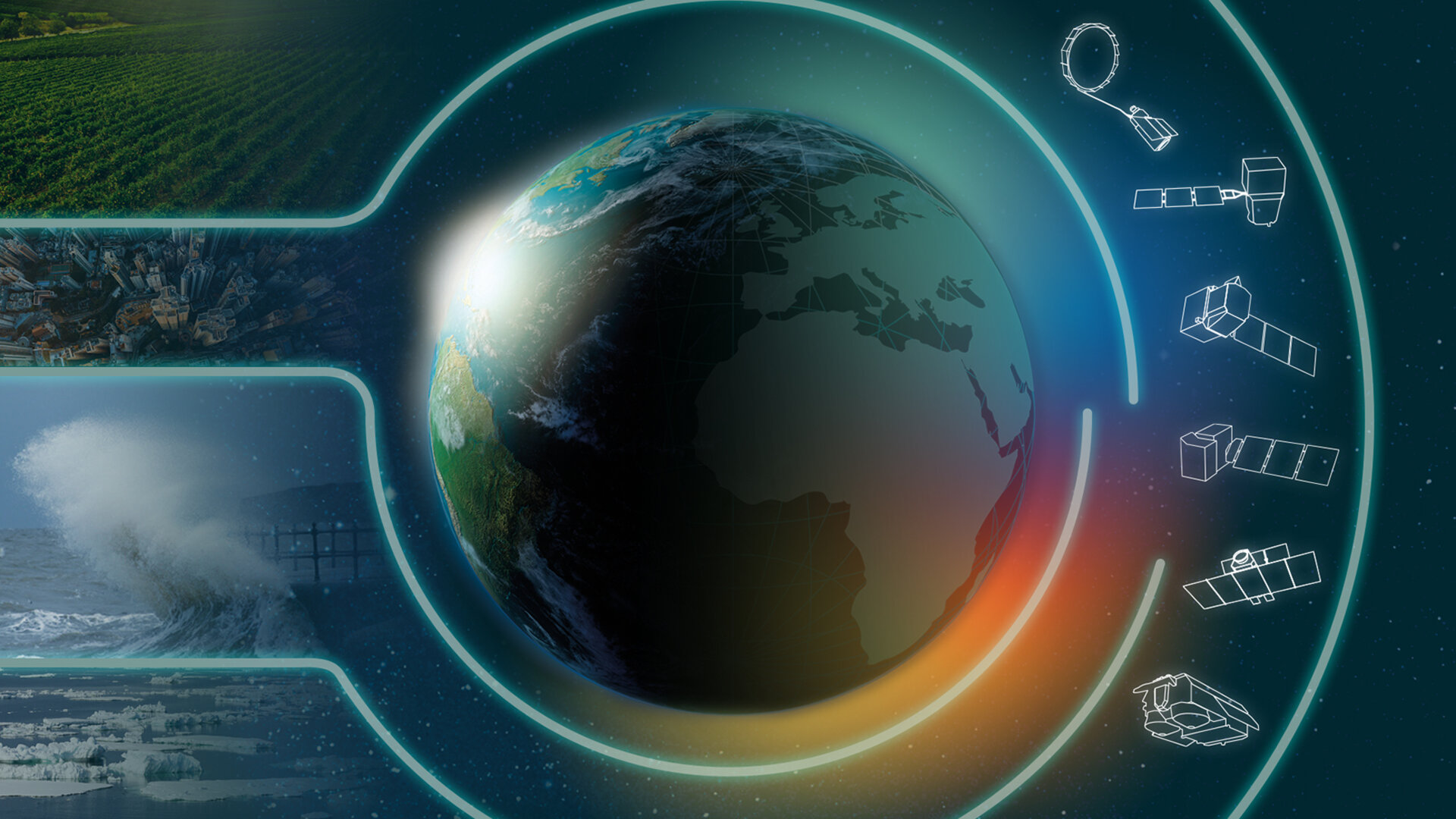
Copernicus is served by a set of six dedicated satellite families, the Sentinels, which are specifically designed to meet the needs of the Copernicus services and their users. The Copernicus Sentinel Expansion Missions will further bolster these efforts, providing even deeper insights into the dynamics of our planet.
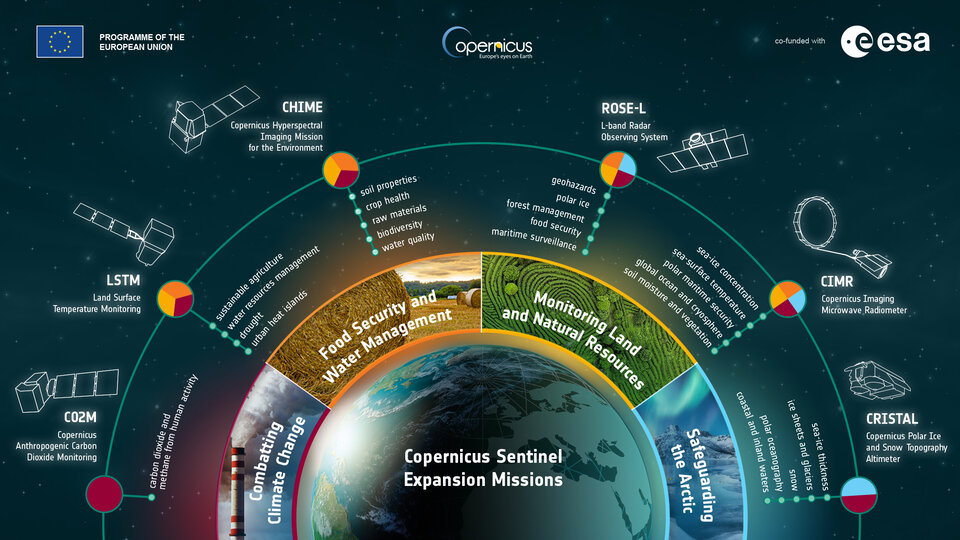
With missions such as CO2M to track greenhouse gas emissions, CIMR to provide detailed insights into sea ice and the polar environment, CHIME to gather hyperspectral observations from Earth’s surface, Cristal to monitor ice thickness and change, LSTM to map land-surface temperature variations, and ROSE-L to improve radar observations, users will be equipped with a wider range of precise data on the state of our planet.
ESA’s Director of Earth Observation Programmes, Simonetta Cheli, said, “The decision by the UK Government to participate to the EU Copernicus Programme has been essential to secure the completion of the Copernicus Sentinel Expansion Missions. These missions are critical for addressing EU policy and gaps in Copernicus user needs, and to expand the current capabilities of the Copernicus Space Component.”
CO2M: Copernicus Anthropogenic Carbon Dioxide Monitoring
The Copernicus Anthropogenic Carbon Dioxide Monitoring (CO2M) mission will be the first of the Sentinel Expansion Missions to be launched. The constellation includes a total of three satellites, CO2M-A and CO2M-B currently under development, and CO2M-C whose implementation will be initiated in 2025. The CO2M satellites will orbit Earth in Sun-synchronous orbits, at an altitude of 735 km.
CO2M's main goal is to help us track greenhouse gas emitters and transparently assess whether nations are on track to meet the emissions targets set by the Paris Climate Change Agreement. CO2M’s passive remote instruments will measure key greenhouse gases, carbon dioxide and methane, which are important indicators of climate change.
In addition, CO2M observations will provide data on aerosol optical depth and nitrogen dioxide levels in the lower atmosphere.

Access the video
CIMR: Copernicus Imaging Microwave Radiometer Mission
The Copernicus Imaging Microwave Radiometer Mission (CIMR) will provide decision-makers with evidence of change and impact in the polar regions – with a focus on the Arctic.
The mission, comprising a constellation of two satellites, features the largest radiometer developed by ESA to provide high-resolution measurements of sea-ice concentration, sea-surface temperature, sea-surface salinity and snow. CIMR places the Arctic in a global context to support solutions for this fragile region and to combat the effects of climate change worldwide.
Positioned in quasi-polar orbits, the A-satellite will follow near-circular, Sun-synchronous orbits, allowing scientists to closely observe changes over time in ice- and sea-covered regions.

Access the video
CHIME: Copernicus Hyperspectral Imaging Mission
The Copernicus Hyperspectral Imaging Mission for the Environment, or CHIME, is being developed to support EU policies on the management of natural resources – ultimately helping to address the global issue of food security.
CHIME will carry a unique visible to shortwave infrared spectrometer to provide routine hyperspectral observations to support new and enhanced services for sustainable agricultural and biodiversity management, as well as soil property characterisation.
CHIME consists of constellation of two satellites, CHIME-A and CHIME-B, that will orbit Earth in a Sun-synchronous orbit at an average altitude of 632 km, covering land around the globe.

Access the video
CRISTAL: Copernicus Polar Ice and Snow Topography Altimeter
The Copernicus Polar Ice and Snow Topography Altimeter (CRISTAL) mission will provide a full picture of the changes taking place in some of the most inhospitable regions of the world.
It will carry – for the first time – a dual-frequency radar altimeter and microwave radiometer, that will measure and monitor sea-ice thickness, overlying snow depth and ice-sheet elevations.
These data will support maritime operations in the polar oceans and contribute to a better understanding of climate processes. CRISTAL will also support applications related to coastal and inland waters, as well as providing observations of ocean topography.
CRISTAL follows-on from ESA’s CryoSat mission, but consists of two identical altimetry satellites, A- and B-units, allowing to ensure the continuity of measurements well within the next decade.

Access the video
LSTM: Land Surface Temperature Monitoring
The upcoming Copernicus Land Surface Temperature Monitoring, LSTM, mission will improve sustainable agricultural productivity in a world of increasing water scarcity and variability.
The mission will carry a high spatial-temporal resolution thermal infrared sensor to provide observations of land-surface temperature. These data are key to understand and respond to climate variability, manage water resources for agricultural production, predict droughts and also to address land degradation.
The LSTM mission will provide actionable information to improve sustainable agricultural productivity and adapt to climate variability.
The mission consists of a constellation of two satellites, LSTM-A and LSTM-B. The satellites will operate in a low-Earth polar orbit with a combined two-day revisit period at the equator.

Access the video
ROSE-L: Radar Observing System for Europe at L-band
The Copernicus Radar Observation System for Europe at L-band (ROSE-L) will provide continuous day-and-night all-weather monitoring of Earth’s land, oceans and ice, and offer frequent observations of Earth’s surface at a high spatial resolution.
ROSE-L, features a constellation of two satellites, that will operate in a Sun-synchronous orbit at an altitude of 693 km and will carry one instrument: the ROSE-L Synthetic Aperture Radar (SAR), designed to provide high-resolution, all-weather imaging with a spatial resolution of 5–10 m. The radar antenna will be the largest deployable planar antenna ever built measuring an impressive 40 sq m.
ROSE-L will deliver many benefits including essential information on forests and land cover, leading to improved monitoring of the terrestrial carbon cycle and carbon accounting.
The mission will also greatly extend our ability to monitor minute surface displacements and helping detect geohazards. It will automatically map surface soil moisture conditions over land helping improve hydrology and weather forecasts and support the operational monitoring of sea and land ice across the Arctic.

Access the video