Germany
 Austria
 Belgium
 Denmark
 Spain
Spain
 Estonia
 Finland
 France
 Greece
 Hungary
 Ireland
 Italy
Italy
 Luxembourg
 Norway
 The Netherlands
 Poland
 Portugal
 Czechia
 Romania
 United Kingdom
 Slovenia
 Sweden
 Switzerland


Sentinel-1C arrives in French Guiana
The Sentinel-1C satellite, the third satellite of the Copernicus Sentinel-1 mission, has arrived at the European spaceport in French Guiana for liftoff on the Vega-C rocket at the end of 2024. The satellite will continue the critical task of delivering key radar imagery of Earth’s surface for a wide range of Copernicus services and scientific applications.
Following its journey from Cannes, France, via Turin, Italy, Sentinel-1C has safely landed in Kourou, French Guiana, after being transported on an Antonov aircraft. It will now undergo a series of launch preparation activities to ensure it is ready for liftoff.

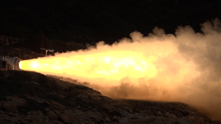
Ramón Torres, Sentinel-1 Project Manager at ESA, commented, “Launching on the Vega-C return to flight is certainly a formidable challenge, but thanks to the extraordinary effort and meticulous planning by AVIO and Arianespace, the Sentinel-1 team is filled with confidence.
“The team is ensuring that no stone has been left unturned to ensure that this extraordinary satellite is launched with the utmost safety and precision. The team eagerly awaits the moment when their hard work and dedication culminate in a flawless launch, marking another milestone for the Copernicus programme.”

Simonetta Cheli, Director of Earth Observation Programmes at ESA, added, "The Sentinel-1 mission highlights the strong partnership between ESA and the European Commission to provide vital radar data that Europe relies on. With Sentinel-1C now in French Guiana, we are furthering the important work of Copernicus."
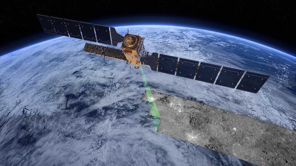
The Copernicus Sentinel-1 mission provides all-weather, day-and-night radar imagery for the global monitoring of Earth's land and oceans – supporting environmental management, disaster response and climate change research.

The Sentinel-1 mission, the first in the family of Copernicus, is based on a constellation of two identical satellites flying in the same orbit but 180° apart, to optimise global coverage and data delivery for Copernicus, the Earth observation component of the European Union’s Space Programme, managed by the European Commission.
Sentinel-1A was the first satellite in the series, launched in April 2014, followed by the launch of Sentinel-1B in 2016. The Sentinel-1B mission came to an end in August 2022 after experiencing a technical fault that rendered it unable to acquire data. The satellite has been successfully de-orbited and will re-enter Earth’s atmosphere within 25 years.
Sentinel-1C will soon take over the role of Sentinel-1B in the mission.
Radar vision for Copernicus
As an advanced radar mission, Copernicus Sentinel-1 can image the surface of Earth through cloud and rain and regardless of whether it is day or night.
Sentinel-1 carries a C-band synthetic aperture radar (SAR) instrument, which allows it to capture high-resolution imagery of Earth's surface. This powerful radar system operates in several modes, including wide swath and high-resolution, providing detailed data on land subsidence, ice movements and ocean conditions.
The SAR instrument is particularly effective for disaster response, such as tracking floods, landslides and oil spills, offering timely and accurate information to support humanitarian and environmental efforts.
The new Sentinel-1C satellite will also carry a new Automatic Identification System (AIS). Developed by the International Maritime Organisation, this system is designed to help ships avoid collisions, particularly when they are too far from land-based radar systems. This technology assigns a unique ID to each vessel and tracks its position and movements in real-time, creating a virtual map of the ships at sea.
By combining radar images from satellites with AIS signals, data users can quickly detect and identify vessels in a large area of the ocean at once in real-time. This is a unique tool not only to track the movement of each ship, showing its ID, direction and speed, but also detect piracy activities – vital for international organisations and companies monitoring global shipping traffic.