Germany
 Austria
 Belgium
 Denmark
 Spain
Spain
 Estonia
 Finland
 France
 Greece
 Hungary
 Ireland
 Italy
Italy
 Luxembourg
 Norway
 The Netherlands
 Poland
 Portugal
 Czechia
 Romania
 United Kingdom
 Slovenia
 Sweden
 Switzerland


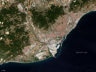
Detecting nitrogen dioxide from power plants with Sentinel-2
Atmospheric nitrogen dioxide is a harmful pollutant with significant impacts on air quality, climate and the biosphere. Although satellites have mapped nitrogen dioxide concentrations since the 1990s, their resolution was generally too coarse to pinpoint individual sources like power plants.
In a recent study, researchers used imagery from Copernicus Sentinel-2 to observe nitrogen dioxide plumes from power plants for the first time – marking a significant advancement in air pollution monitoring.
Nitrogen dioxide is primarily released from human-produced emissions such as fossil fuel combustion by vehicles and power plants as well as natural sources, like lightning or wildfires. Nitrogen dioxide significantly impacts air quality and contributes to smog and respiratory problems. It is a critical component of smog, producing the yellow-brown colour of the smog we see in the air.
Detecting and quantifying nitrogen dioxide emissions is crucial for understanding their environmental impact and for developing strategies to reduce air pollution.
Traditionally, satellites like the Copernicus Sentinel-5P satellite have been used to map nitrogen dioxide concentrations but their resolution has often been too coarse to pinpoint specific sources like power plants, without averaging many observations.
However, new research shows that both the Copernicus Sentinel-2 and US Landsat satellites can now detect and measure nitrogen dioxide plumes from individual power plants with remarkable precision.
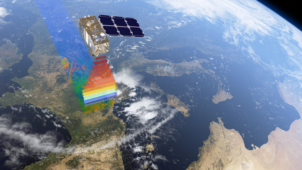
The Sentinel-2 satellites were designed to capture high-resolution images of Earth’s surface to monitor land and natural resources, not air pollution. Traditionally, their primary use has been in monitoring land cover, vegetation and water bodies due to their fine spatial resolution.
However, recent advancements have shown that Sentinel-2 can also detect nitrogen dioxide plumes. This capability stems from its high spatial resolution, which allows it to capture detailed images that can reveal the presence of nitrogen dioxide in the atmosphere – even though it has fewer spectral bands compared to hyper-spectral instruments.
By utilising the visible and near-infrared bands, researchers can pinpoint nitrogen dioxide emissions from specific sources, such as power plants, and when combined with long-term records from the Landsat satellites, emission trends over time can be analysed.
The study focused on power plants in Saudi Arabia and the United States. Researchers used images from the blue and ultrablue bands of both satellites to identify nitrogen dioxide plumes.
The high-resolution images allowed them to estimate the emission rates of nitrogen oxides from several large power plants, including those in Riyadh, Saudi Arabia, and Wyoming, USA.
One key finding was from Riyadh power plant 9, where a 13-year analysis from 2009 to 2021 showed significant seasonal variations in emissions. During the summer, when air conditioning use is high, emissions peaked.

Daniel Varon, lead researcher of the paper, commented, “This unexpected capability means that Landsat and Sentinel-2 can be used to detect nitrogen dioxide emissions with fine spatial resolution, which is particularly useful in urban areas where pollution sources are numerous and close together.
“Our findings add to the utility of the Sentinel-2 satellites, allowing them to contribute to air quality monitoring by pinpointing pollution sources, which has been challenging for traditional nitrogen dioxide-sensing satellite instruments.”
The use of these satellites for air pollution monitoring is not without its challenges.
Daniel explains, “We find that the satellites perform best over bright and uniform surfaces and can struggle in areas with complex terrain or dark surfaces. However, even with these limitations, they offer a powerful new tool for identifying and monitoring pollution sources.”
The study's success in using Landsat and Sentinel-2 satellites for this purpose opens new possibilities for environmental monitoring. It provides a new way to understand and combat air pollution, especially in regions where traditional monitoring systems are lacking.
By leveraging these satellites, researchers and policymakers can gain better insights into the sources and trends of nitrogen dioxide emissions, helping to create more effective strategies for improving air quality and protecting public health.
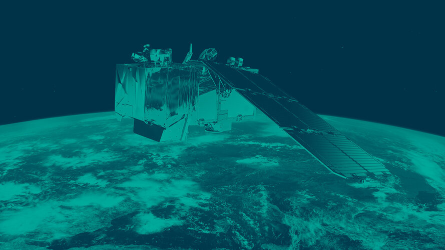
About Copernicus Sentinel-2
The Copernicus Sentinel-2 mission provides high-resolution optical imagery to monitor land use and change, soil sealing, land management, agriculture, forestry and natural disasters including floods, forest fires and landslides.
The mission consists of twin satellites, Sentinel-2A and Sentinel-2B, launched in 2015 and 2017, respectively. The upcoming launch of Sentinel-2C on 4 September 2024 will extend this capability further.

Sentinel-2C, like its predecessors Sentinel-2A and -2B, will continue the mission's legacy by providing critical data for environmental monitoring, generating optical images from the visible to the shortwave infrared region of the electromagnetic spectrum.
From an altitude of 786 km, the 'C' satellite will provide continuous imaging in 13 spectral bands with resolutions of 10, 20 or 60 metres and a uniquely large swath width of 290 km.
The Sentinel satellites are part of Copernicus, Europe's environmental monitoring programme, managed by the European Commission in partnership with ESA.