Germany
 Austria
 Belgium
 Denmark
 Spain
Spain
 Estonia
 Finland
 France
 Greece
 Hungary
 Ireland
 Italy
Italy
 Luxembourg
 Norway
 The Netherlands
 Poland
 Portugal
 Czechia
 Romania
 United Kingdom
 Slovenia
 Sweden
 Switzerland


Sentinel-2 unveils the seasonal rhythm of intertidal seagrass
Thanks to an ESA-funded project and data from the Copernicus Sentinel-2 mission, researchers have revealed seasonal variations in intertidal seagrass across Western Europe and North Africa. As a key indicator of biodiversity, these new findings offer valuable insights for the conservation and restoration of these vital ecosystems.
The intertidal zone is the area where the ocean meets the land between high and low tides, and here seagrasses can form extensive meadows. These flowering marine plants provide critical habitats, acting as shelter, nurseries, and feeding and spawning grounds for a diverse range of birds, fish and invertebrates. Beyond their ecological importance, seagrass meadows also stabilise sediments and protect coastlines from erosion.
Monitoring the occurrence, extent, condition and diversity of intertidal seagrass as a key biodiversity variable is essential for assessing the overall health of local ecosystems.

Current global estimates of seagrass coverage do not differentiate between seagrasses in the intertidal zone and those in the subtidal zone, which remain submerged below the sea surface.
However, a recent paper, published in Communications Earth & Environment, details how a team of scientists used high-resolution imagery from the Copernicus Sentinel-2 mission to demonstrate its ability to map intertidal seagrass meadows and their seasonal changes across continents with consistency and precision.
Their research was funded by one of ESA’s Science for Society projects called Biodiversity of the Coastal Ocean, or BICOME.
Bede Ffinian Rowe Davies from Nantes University in France and lead author of the paper, said, “Coastal regions, like much of the world, are experiencing rapid and alarming biodiversity loss. To address this, it’s crucial to develop efficient monitoring methods so that timely and appropriate action can be taken to preserve delicate ecosystems.
"Using data from Sentinel-2 within the BiCOME project, we were able to reveal significant seasonal variations in intertidal seagrass. The peaks in extent shifted by as much as five months – challenging previous assumptions that there was little or no seasonal fluctuation."

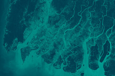
As examples, the satellite images displayed above show the changes in intertidal seagrass cover in the Cádiz Lagoon, Spain. One was taken in May 2018 and the other in November 2021.
The satellite images below illustrate changes in intertidal seagrass cover in the Bay of Bourgneuf, located north of the Bay of Biscay, off the western coast of France. The image on the left, from April 2021, shows sparse intertidal seagrass, while the image on the right, from September 2021, reveals abundant growth.

Victor Martinez-Vicente, BiCOME project principal investigator, noted, “This study demonstrates the potential of satellite observations to track changes in the extent of natural coastal ecosystems, providing valuable insights for indicators in the Global Biodiversity Framework. Further research is needed to develop long-term satellite-based monitoring systems and datasets to support global progress toward achieving the framework goals.”
ESA’s Marie-Helene Rio, added, “These new findings clearly demonstrate the value that Sentinel-2 can bring to monitoring intertidal seagrass. We now believe that these intertidal meadows behave differently to the type of seagrass that spends most of its life submerged by seawater. This suggests that previous estimates, which grouped the two types together, could be misleading.”
“The research paves the way to further monitoring and assessment of intertidal seagrass meadows using Sentinel-2 data.”
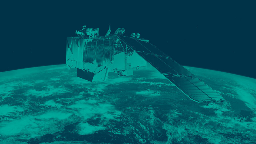
The Sentinel-2 satellites each carry a multispectral imager that takes high-resolution images of Earth’s land, islands, and inland and coastal waters. And with a large swath width of 290 km, it provides these images in 13 spectral bands with resolutions of 10 m, 20 m and 60 m.
The third Sentinel-2 satellite, Sentinel-2C, was launched on 5 September 2024, and has already delivered its first images of Earth.