What’s going on with the ozone?
World governments agreed in the late 1980s to protect Earth’s ozone layer by phasing out ozone-depleting substances emitted by human activities, under the Montreal Protocol. The phase out of these substances has not only helped protect the ozone layer for future generations but has also protected human health and ecosystems by limiting the harmful ultraviolet radiation from reaching Earth. On 16 September, the International Day for the Preservation of the Ozone Layer, we take a closer look at this year’s ozone hole.
The ozone layer in the atmosphere protects Earth from potentially harmful ultraviolet radiation. In the 1970s, scientists discovered that the ozone layer was being depleted.
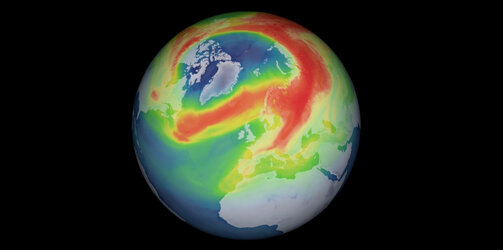
Atmospheric conditions of ozone vary naturally depending on temperature, weather, latitude and altitude, while substances ejected by natural events such as volcanic eruptions can also affect ozone levels. However, these natural phenomena couldn’t explain the levels of depletion observed and it was discovered that certain human-made chemicals were the cause.
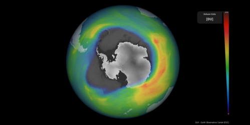
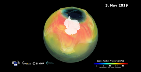
Ozone depletion is greatest at the South Pole. This depletion creates what is known as the ‘ozone hole.’ From August to October, the ozone hole increases in size – reaching a maximum between mid-September and mid-October.
The Montreal Protocol was created in 1987 to protect the ozone layer by phasing out the production and consumption of these harmful substances, which is slowly leading to its recovery. Some of the ozone-depleting substances emitted by human activities remain in the stratosphere for decades, meaning that ozone layer recovery is a very slow, long process.
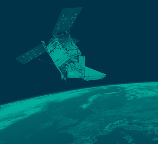
The Montreal Protocol demonstrates the power of international commitment to protecting our environment. Satellite data provide a good means to monitor changes of the ozone layer on global scale. Ozone measurements from the Copernicus Sentinel-5P satellite extend the European time-series that started in 1995 with the Global Ozone Monitoring Experiment (GOME).
These data can be used for long-term trend monitoring and provide ozone measurements just three hours after measurement time to the Copernicus Atmosphere Monitoring Service (CAMS), operated by the European Centre for Medium-Range Weather Forecasts (ECMWF) for ozone monitoring and forecasting.

The ozone hole today
Data from Sentinel-5P was used to show that last year’s ozone hole over the Antarctic was one of the largest and deepest in recent years. The hole grew rapidly from mid-August and peaked at around 25 million sq km on 2 October. The large ozone hole was driven by a strong, stable and cold polar vortex which kept the temperature of the ozone layer over Antarctica consistently cold. This was in stark contrast with the unusually small ozone hole that formed in 2019.
This year, the ozone hole’s evolution appears to be similar to last year’s size, currently around 23 million sq km – reaching an extent larger than Antarctica. According to CAMS, the 2021 ozone hole has considerably grown in the last two weeks and is now larger than 75% of ozone holes at that stage in the season since 1979.
Antje Inness, a senior scientist at ECMWF, commented, “This ozone evolution is what we would expect given the current atmospheric conditions. The progress of the ozone hole over the coming weeks will be extremely interesting.”
ESA’s Copernicus Sentinel-5P mission manager, Claus Zehner, added, “Sentinel-5P ozone measurements are a key contribution to global ozone monitoring and forecasting in the frame of the Copernicus programme.
“The monitoring of the ozone hole over the South Pole must be interpreted carefully as the size, duration and the ozone concentrations of a single hole are influenced by the local wind fields, or meteorology, around the South Pole. Nevertheless, we expect a closing of the ozone hole over the South Pole by the year 2050.”

Looking ahead
Satellites orbiting above are the only way of measuring the ozone’s recovery and change in a consistent and systematic manner. Most ozone-measuring satellites, such as the Copernicus Sentinel-5P mission, provide a value for the amount of ozone in a column – meaning the total amount of ozone in a column of air from the ground to the top of the atmosphere. In conjunction, profiles, which show concentrations at different altitudes, are also needed to gain the full picture.
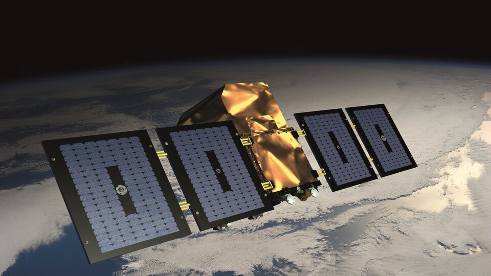
The upcoming Atmospheric Limb Tracker for Investigation of the Upcoming Stratosphere (Altius) mission, set to launch in 2025, will deliver profiles of ozone and other trace gases in the upper atmosphere to support services such as weather forecasting, and to monitor long-term trends.
Altius carries a high-resolution 2D imager that observes ozone from side-on, at Earth's limb or atmospheric boundary. This limb-sounding technique allows ozone to be viewed at different altitudes, thereby providing vertical profiles of different ozone concentrations. As well as ozone, Altius will also deliver profiles of other trace gases such as nitrogen dioxide, water vapour and aerosol information.
Read more about the mission here: Altius.


 Germany
 Austria
 Belgium
 Denmark
 Spain
Spain
 Estonia
 Finland
 France
 Greece
 Hungary
 Ireland
 Italy
Italy
 Luxembourg
 Norway
 The Netherlands
 Poland
 Portugal
 Czechia
 Romania
 United Kingdom
 Slovenia
 Sweden
 Switzerland


