Germany
 Austria
 Belgium
 Denmark
 Spain
Spain
 Estonia
 Finland
 France
 Greece
 Hungary
 Ireland
 Italy
Italy
 Luxembourg
 Norway
 The Netherlands
 Poland
 Portugal
 Czechia
 Romania
 United Kingdom
 Slovenia
 Sweden
 Switzerland


Satellite and instruments
The Copernicus Sentinel-6 mission comprises two identical satellites launched five years apart to extend the gold standard record of sea-surface height measurements until at least 2030. It also provides near-real time measurements of sea-surface height, significant-wave height and wind speed to support operational oceanography. Over land surfaces, Sentinel-6 provides information on the height of rivers and lakes in support of hydrology applications.

Access the video
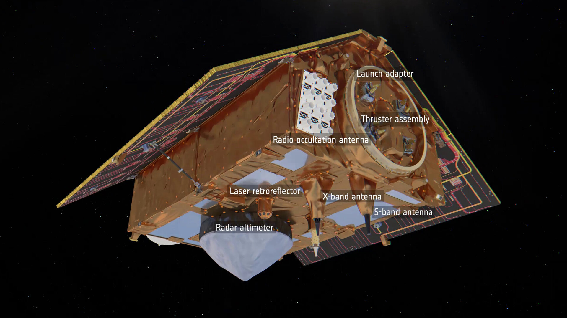
The mission builds on heritage from the French–US Jason series, ESA’s CryoSat and the Copernicus Sentinel-3 missions. Developed by ESA, the main instrument is the Poseidon-4 dual-frequency (C-band and Ku-band) radar altimeter. It improves on precision and stability of the radar altimeters on the Jason series and also inherits a high-resolution synthetic aperture radar mode from CryoSat and Copernicus Sentinel-3, but with a design that allows synthetic aperture radar and low-resolution modes to deliver data simultaneously.
Access the video
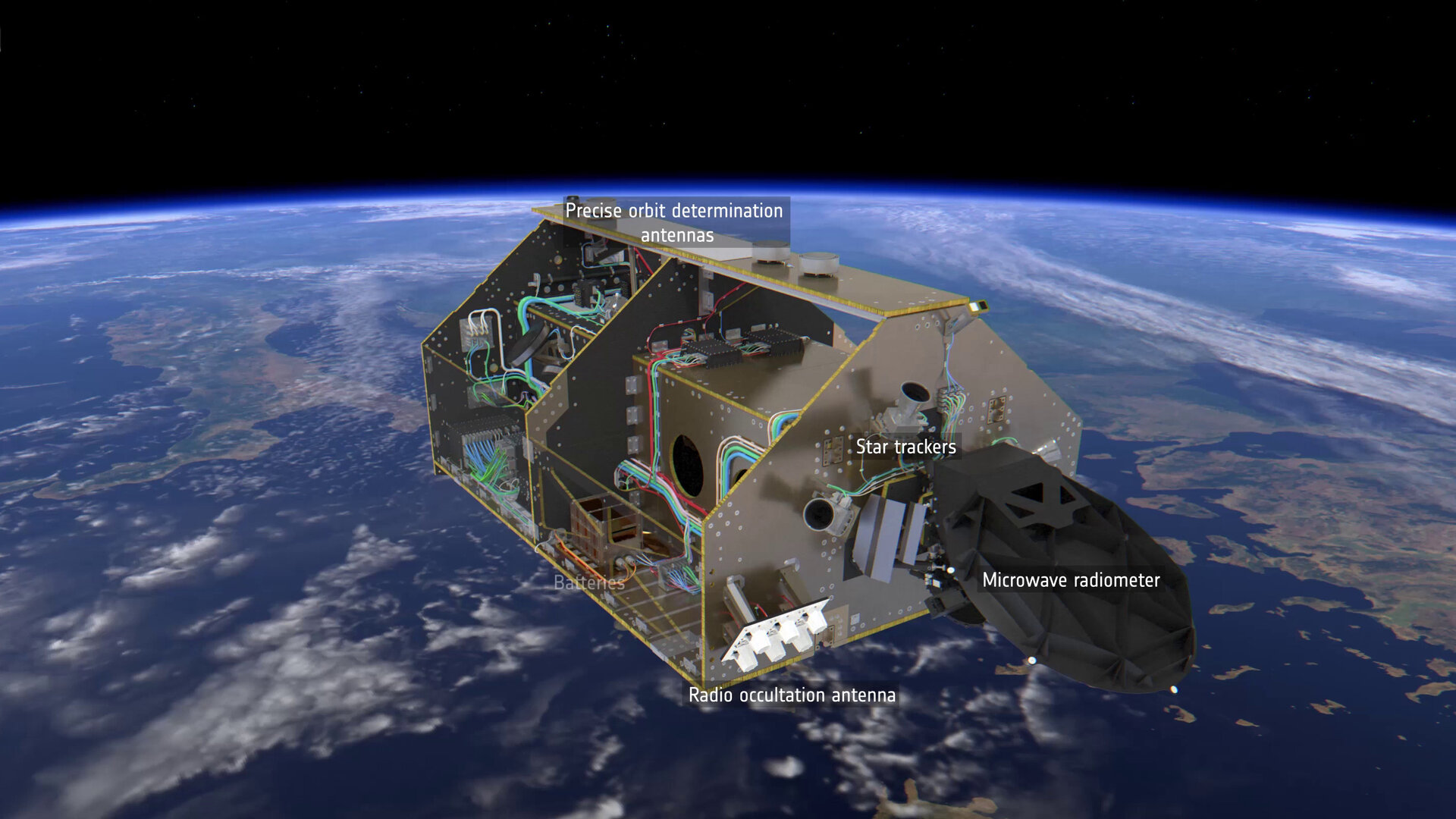
An advanced microwave radiometer, provided by NASA, supports Poseidon-4. Water vapour in the atmosphere affects the speed of the altimeter’s radar pulses – and therefore estimates of sea-surface height. The advanced microwave radiometer accounts this water vapour to ensure that measurements are accurate.
The satellites also carry a precise orbit determination package, including a GPS receiver and a laser retroreflector.