Data products
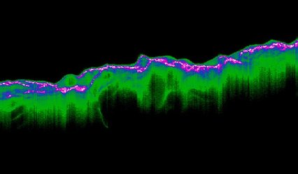
The complex waveform datastream from CryoSat’s altimeter requires a sophisticated processing scheme, in particular for exploiting the synthetic aperture and interferometry techniques over ocean and ice surfaces.

The main data product is the 'Level-2' product, sometimes called the Geophysical Data Record. This contains the surface elevation along the ground track together with all auxiliary data needed to fully exploit these measurements.
Other data products are also available for specialised users (such as radar scientists) which contain the radar echoes at various levels of processing.


 Germany
 Austria
 Belgium
 Denmark
 Spain
Spain
 Estonia
 Finland
 France
 Greece
 Hungary
 Ireland
 Italy
Italy
 Luxembourg
 Norway
 The Netherlands
 Poland
 Portugal
 Czechia
 Romania
 United Kingdom
 Slovenia
 Sweden
 Switzerland


