Calibrating GOCE
A gradiometer and a space-qualified GPS receiver were developed according to the specifications necessary for the high demands of the GOCE mission. Obviously, the technical demands for these instruments were very stringent, and they were manufactured with the utmost precision.
In reality, instruments are never perfect. The minor differences between the actual instrument and the ideal design on paper are referred to as imperfections. Scientists accept that the accelerometers, the gradiometer and the GPS receiver on GOCE had slight imperfections, as all instruments do, but were able to partly compensate for this using a process of calibration and validation.
A full calibration procedure for GOCE was rather complicated. It is clearest when divided in to several steps, namely calibration activities that took place on ground before the mission launched, activities that were performed (repeatedly) in-flight during the mission, and post-mission activities. These three steps are known as:
- pre-flight calibration
- internal calibration
- external calibration
'Full calibration' refers to the ensemble of activities in these three steps. All three steps are necessary to obtain the best data product, and should not really be looked at as separate entities.
Pre-flight calibration
This calibration step:
- constituted a first estimate of the so-called common mode rejection ratio (CMRR) and differential mode rejection ratio (DMRR) to the 10-4 level
- made sure that the accelerometer output was obtained in the required physical units to a certain level of accuracy, say to within 1%.
The CMRR and DMRR refer to the coefficients that account for common mode and differential mode couplings due to imperfections of the gradiometer instrument, like mis-alignments, differential scale-factors, etc.

Pre-flight calibration was performed before the mission, on the ground, using a test-bench. The accelerometers were tested first, then accelerometer pairs mounted on the gradiometer arms and finally the complete assembly. This process basically consisted of rocking the accelerometers in a controlled direction on a pendulum bench. The 1-g environment, which was sustained by the vertical, less-sensitive axis, projected over the sensitive perpendicular axes and was measured by them. The differences in these readouts provided information about the actual alignments of the axes. By rocking in different directions, it was possible to determine all the ground calibration parameters.
In fact, the biggest difficulty with pre-flight calibration was that the 1-g environment on Earth prevents a proper calibration of the accelerometers since they were designed to operate with the highest accuracy in a 0-g environment. To compensate for this a microgravity test in free fall, utilising a 'drop tower' was also performed.
Internal calibration
During the mission, internal calibration was done on board the satellite using the thrusters. A procedure was designed which made it possible to first calibrate the thrusters using the (un-calibrated) accelerometer measurements. Then, the procedure continued by activating the calibrated thrusters in a certain mode, which put a known non-gravitational signal on the accelerometers. The signals of all the accelerometers were then analysed. From the differential mode signals along each arm the internal calibration parameters could be worked out.
More specifically, the internal calibration procedure provided information on relative scale factors and relative misalignments between accelerometer pairs on each arm and on common misalignments of accelerometer pairs on each arm.
External calibration
External calibration aims to establish that the gradient observations really represent the gradients of the gravity field in Eötvös Units, that remaining unresolved errors are corrected for and that the observations are obtained with the required (or in any case with a known) accuracy. Typically, external data are used in this step, normally in the form of ground data or existing models, hence its name 'external calibration'.
Satellite-to-Satellite Tracking observations
Satellite-to-Satellite Tracking observations (SST) refer to determining the orbit of GOCE using GPS measurements. Gravity field parameters were derived from the combination of the GPS observations and the accelerometer common mode observations. Since GPS is a mature technique for which the instrumentation could be properly calibrated on-ground, the process was reasonably straightforward.
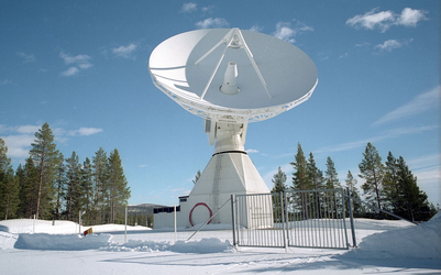
Pre-flight calibration consisted of calibrating the GPS receiver. This was done by comparing observations made by the GOCE receiver with other GPS receivers, collocated SLR (Satellite Laser Ranging) ground stations or accurately determined baselines.


 Germany
 Austria
 Belgium
 Denmark
 Spain
Spain
 Estonia
 Finland
 France
 Greece
 Hungary
 Ireland
 Italy
Italy
 Luxembourg
 Norway
 The Netherlands
 Poland
 Portugal
 Czechia
 Romania
 United Kingdom
 Slovenia
 Sweden
 Switzerland


